Who lives there?
Over seven million people live here, the majority in the Sydney area on the east coast. Most people speak English; no other language accounts for as many as one in twenty speakers, and most of the minorities are urban immigrants.
I do not know the breakout of religion by state, but the pattern in each presumably approximates the national one. Relgious statistics vary wildly, but is is safe to way that more than 19 in 20 Australians are culturally Christian, that most of those remain observant, and that observance is represented chiefly by Anglican Protestants and Roman Catholics, with other Christians together consituting less than either of these groups.
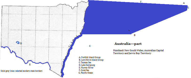
There is only one city with a metropolitan population exceeding one million, Sydney, and three smaller cities, Newcastle, Wollongong and Canberra, the national capital.
Map
Who was there before?
Before the late 18th century only Australian languages were spoken here, and everyone followed similar spiritulaist religions. These groups may have been here 20,000 years or more.
Contacts from the north had very little impact, but the arrival of the British overwhelmed local cultures, due to genocide, intentional cultural destruction, persistent slavery, aggressive Christian proselytyzing, and the pragmatic advangages of assimilation. Other Europeans were invited to join the English speakers and assimilate, and very recently Asians have been allowed to join them.
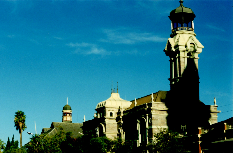
Broken Hill, New South Wales, Australia
Around the area
north
east from the northeast
east
south
west
Footnotes
1. The Murray-Darling combination is Oceania's longest river.
2. Oceania's second longest.
3. The sites group as follows: Shield Volcano Area: Border Ranges, Mount Warning and Nightcap National Parks, Limpinwood and Numinbah Nature Reserves and Amaroo Floral Reserve; Focal Peak Area: Mount Nothofagus National Park and Wilson's Peak and Mount Clunie Floral Reserves; Washpool and Gibraltar Range Area: Washpool and Gibraltar Range National Parks; Iluka Nature Reserve; New England Area: New England and Dorrigo National Parks and Mt. Hyland Nature Reserve; Hastings-Macleay Area: Willi Willi National Park and Werrikimbe and Mt. Seaview Nature Reserves; Barrington Tops Area: Barrington Tops National Park and Kerripit Beach Flora Reserve; and--south of Port Macquarie--Fenwicks Scrub Floral Reserve.
4. The sites are: Blue Mountain, Wollemi, Yengo, Nattai, Kanangra-Boyd, Gardens of Stone and Thirlmere Lakes National Parks and Jenolan Caves Karst Conservation Reserve. The Jamison Valley in Blue Mountains National Park is especially popular.
5. The Lord Howe Island Group is part of the state of New South Wales.
6. This site also honors culture.
7. Many of the remaining Protestants have joined in a Uniting Church.
8. Information about ports comes from The Times Atlas of the Oceans (Van Nostrand Reinhold Company, 1983), "commodity loading ports" map.