| To Duval Family Home Page | South America |
| To Chris Home Page | Hispano-America |
| To Earth (Geography Home Page) |
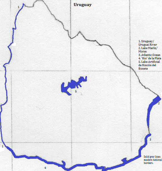
In the south is a continuation of the pampas, grassy plains. They rise toward the northeast with an alternation of low and high land: low at the Uruguay River, the Negro
More than 19 in 20 speak Spanish and are of a Roman Catholic Christian background, although many are non-observant.
Montevideo is the only city with a million or more residents. Other cities include Colonia del Sacramento, the Maldonado metropolitan area, Rivera and Salto.
Besides the city sites, tourists visit the Casapueblo (a house and memorial of Carlos Perez Vilara) in the town of Punta Ballena and the resort, 'José Ignacio.'
Two groups arrived about 4,000 years ago: the Charrua and the Tupi-Guarani. They were genocided or assumulated or died of European diseases after the Spanish arrived, so little is known of their local culture.
northeast
south
southwest, across the head of the Rio de la Plata
west
1. Translates from Spanish as black.
2. Translates from Spanish as knife.
3. Translates from Spanish as big.