| To Duval Family Home Page | Africa |
| To Chris Home Page | Republic of South Africa/ Afrika/ Aforika/ Afurika |
| To Earth (Geography Home Page) | United Kingdom and its possessions |
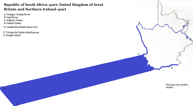
These 491 thousand square kilometers are in the southwest corner of Africa, and make up the western part of the Republic of South Africa.
The larger river basins adhere to the physiographic pattern. The Orange enters from the east, flows northwest through the Vanderkloof Dam Reservoir, turns west when it receives the Vaal from the northeast, and heads to the Atlantic along Northern Cape Province's northwest border. Its chief left bank tributary is the Brak. In the southwest of the plateau, the Sak's system ends in a sink. A few coastal rivers cut through ranges: the Doring, which begins east of the Swartruggens and goes northwest; the Gourits, whose feeds reach from the Nuweveld Mountains on their way south; and the Sout, which begins near the source of the Brak, and heads southeast into Eastern Cape Province.
This area also includes volcanic British islands in the mid-Atlantic: Tristan da Cunha and some nearby islands further south, near the junction of the mid-Atlantic and Walvis ridges; and Gough Island, southeast of Tristan da Cunha. The Inaccessible Islands near Tristan da Cunha and Gough Island together constitute a UNESCO World Heritage Site. Gough Island has 48% of the world's rock hopper penguins and 54 other bird species, including up to three million breeding pairs of the great shearwater, and two endangered species: the wandering albotross and the southern giant petrel.
The majority, more than 11 in 20, speak Afrikaans. More than two in ten speak Xhosa
Protestant Christianity is the majority religion. This includes the Dutch Reformed Church and the African Independent Churches, also called Zionist Churches. A minority of Xhosa practice local religions, which include a belief in ancestral spirits, a distant creator god, the potential harm of sorcerors or witches and the potential help of diviners. There are also significant numbers without any religion, and similar numbers of Moslems, both mostly in Cape Town.
Cape Town is the only city with more than one million residents.The older inhabitants spoke languages ancestral to Khoe and !Xam, also called 'Cape Bushman', which belong to distinct language groups. A third language group, the Nguni, came to this area from Natal some time after the ninth century. Intermarriage with the Khoe, along with peculiar rules forcing Nguni women to substitute for forbidden syllables--often by interlingual borrowing, led to Xhosa, an Nguni language, acquiring many features of Khoe, such as click consanants.
Meanwhile Dutch speakers arrived and founded Cape Town in the 17th century. Over time, one descendent of Dutch evolved, with borrowings from Portuguese, Malay, Bantu languages and Khoisan languages: today's Afrikaans. The Dutch also introduced Dutch Reform Christianity. The British first arrived in significant numbers in the early 19th century, triggering a migration of large numbers of Afrikaaners who disliked the British prohibition of racial slavery. The British, besides adding another European language, contributed to the variety of Protestant Christianity. Missionaries converted large numbers of Xhosa, and the British undermined indiginous ways by forbidding payments to brides' families (lobola).
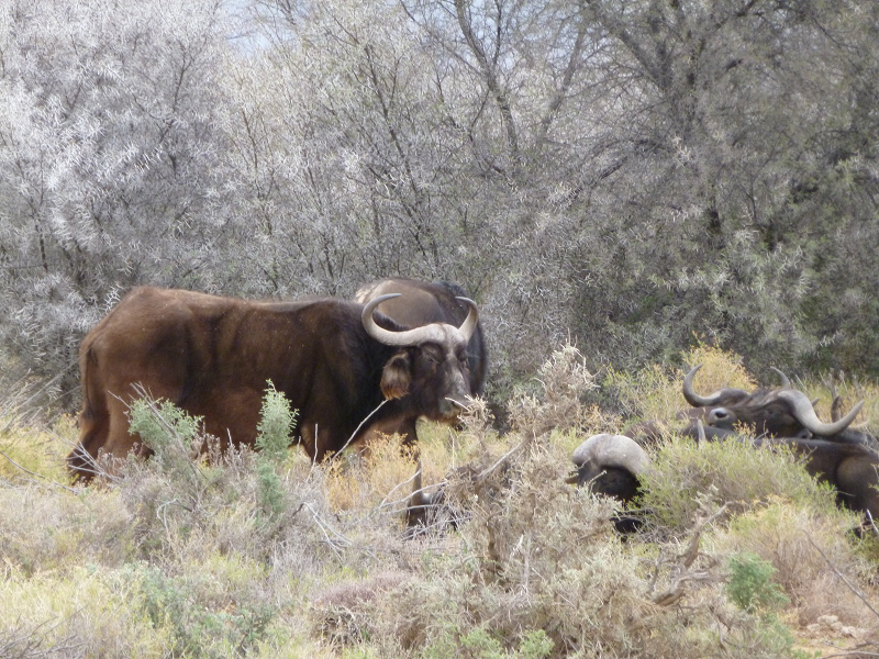
Cape buffalo, Iverdoorn Safari Park, Western Cape Province, South Africa/ Afrika
north
east of Northern Cape Province
east of Western Cape Province
south, from east of Cape Agulhas
southwest, from west of Cape Agulhas, and west
northwest
1. Afrika in Afrikaans, Southern Ndbele, Xhosa, Zulu, Swazi, Northern and Southern Sotho and Tsonga; Aforika in Tswana; and Afurika in Venda.
2. Swart is black in Afrikaans.
3. Great in English.
4. Mountains are berge in Afrikaans.
5. UNESCO, World Heritage Sites (Firefly Books, 2010).
6. Also called IsiXhosa.
7. See Andrew Dalby, Dictionary of Languages (Columbia University Press, 1998).
9. www.CountryStudies/south-africa/52.htm, accessed November 17, 2007.