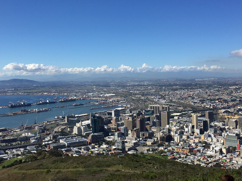
Overlook of Cape Town, Western Cape Province, South Africa/ Afrika
| To Duval Family Home Page | Africa |
| To Chris Home Page | Republic of South Africa/ Afrika/ Aforika/ Afurika |
| To Earth (Geography Home Page) |
Cape Town,
The tallest building is the 28 story Metlife Building, topped by a 22 meter spire. Also famous are: the Thibault Building, which is skewed 45 degrees to the city grid and faced with dark granite intended to match Table Mountain; the Atterbury House (formerly Shell House), which in 1976 was thought to be the tallest building with four corner columns with free spanning beams; the Civic Center, through which a major road passes; the red-and-white striped Green Point Lighthouse (1824); and the Cape Town City Hall (1905). Also notable in the skyline is Green Point Stadium, which seats up to 70 thousand sports spectators.
Table Mountain National Park, consisting of Table Mountain, Silvermine-Tokai and Cape Point sections, is important not only for scenary but for its flora. It is one of the eight areas that together constitute the UNESCO World Heritage Site called Cape Floral Region Protected Areas.
A quite different World Heritage Site is Robben Island, a notorious prison that, amongst others, housed famous anti-apartheid freedom-fighters.
Cape Town International Airport is one of the nation's two airports serving passengers going beyond the continent and nearby islands.
Cape Town is an important grain port.
| Year | Population | Political entity |
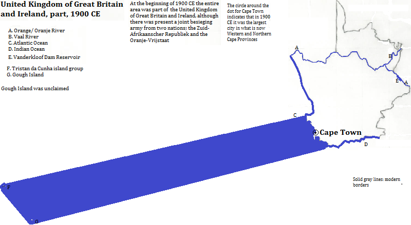
| 1900 CE | 148,000| United Kingdom of Great Britain and Ireland | |
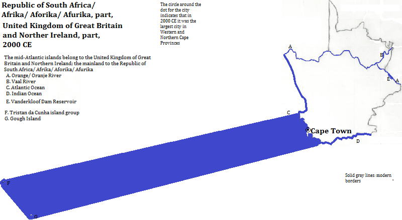
| 2000 CE | 3,500,000| Republic of South Africa/ Afrika/ Aforika/ Afurika | |
Overlook of Cape Town, Western Cape Province, South Africa/ Afrika
1. Kaapstad in Afrikaans or iKapa in Xhosa.
2. Afrika in Afrikaans, Southern Ndbele, Xhosa, Zulu, Swazi, Northern and Southern Sotho and Tsonga; Aforika in Tswana; and Afurika in Venda.
3. Information about buildings is from emporis.com, accessed 1/5/2013.
4. Alastair Cooper, ed., The Times Atlas of the Oceans (Van Nostrand Reinhold Company, 1983), "commodity loading ports" map.
5. Tertius Chandler, Four Thousand Years of Urban Growth, 2nd ed. (The Edwin Mellen Press, 1987), "Tables of World's Largest Cities". Cape Town was the largest city in what is now the Western and Northern Cape Provinces in 1900 and 2000. The status in 2000 and the populations in 2007 come from world-gazetteer.com. The population for 2000 was a linear interpolation between the 1996 population of 2.8 million and the 2012 calculated population of 5.5 million, both bounding figures coming from word-gazetteer.com.