| To Duval Family Home Page | North America | Anglo-North America |
| To Chris Home Page | United States of America | |
| To Earth (Geography Home Page) |
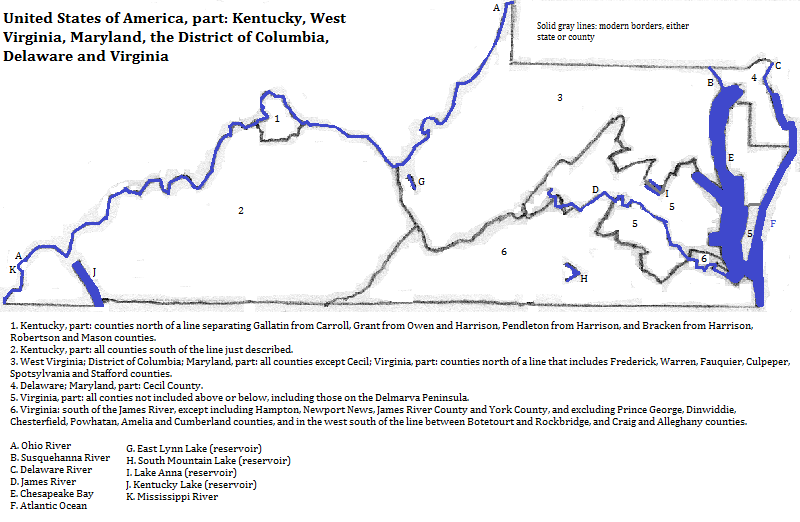
This part of the United States includes three of the country's physiographic zones. The southwest corner of Kentucky is part of the Atlantic Coastal Plain--divided between the Mississippi Alluvial Plain and the East Gulf Coastal Plain. Central Kentucky is in the Interior Low Plateaus of the Interior Plains. Eastern Kentucky, all of West Virginia, most of Virginia and Maryland and the very northern tip of Delaware all fall within the Appalachian Highlands. Finally Virginia and Maryland below the fall line, and most of Delaware are in the Embayed Section of the Atlantic Coastal Plain. This includes a peninsula shared by three states, the Delmarva, which nearly shuts off Chesapeake Bay from the rest of the Atlantic.
The Appalachian Highlands are divided here into four geologic provinces, aligned southwest to northeast. Westernmost are the Appalachian Plateaus. Then comes the Valley and Ridge Province. Next is the Blue Ridge Province, and last the Piedmont Province (both Upland and Lowlands Sections).
Mammoth Cave National Park near Bowling Green, Kentucky, is a UNESCO World Heritage Site honoring its 510 kilometers of passageways and 200 indigenous species.

These states are in the part of North America in which English-speakers and Christians are the majority.
There are four
Smaller cities of note are Charleston, West Virginia; Charlottesville, Virginia; and Bowling Green, Kentucky.
The western part of the area includes part of the Marcellus Shale, a source of natural gas.
There was a mixture of speakers of Algonquian and Iroquois languages around Chesapeake Bay. Their numbers were much reduced by smallpox in the 17th century. Farther west in today's northern Kentucky there was another Algonquian group, the Shawnee.
The English were the first Europeans in the area, invading from the coast and expanding westward, while the French arrived later via the Mississippi and Ohio River systems. (There was also a brief Swedish colony that gave way to the British.) The Anglo-Americans were the victors between the two rival European groups and violently displaced the natives. Some of them brought slaves, descended from Africans, into the area.
northwest of West Virginia and north of Kentucky
northeast of West Virginia and north of Maryland and Delaware
surrounding the Delmarva Peninsula and east of the rest of Virginia
south
west of Kentucky
northwest of western Kentucky
1. UNESCO, World Heritage Sites (Firefly Books, 2010).
2. Wilmington, Delaware and one county in Maryland are considered part of the Philadelphia (or Philadelphia-Camden-Vineland) metropolitan area. See http://en.wikipedia.org/wiki/Pennsylvania_statistical_areas, accessed 9/2013. Some counties in northern Kentucky are part of the Cincinnati (or Cincinnati-Middleton-Wilmington) metropoliatan area. See http://en.wikipedia.org/wiki/Ohio_statistical_areas, accessed 9/2013. These are centered beyond this area.
3. From http://en.wikipedia.org/wiki/Kentucky_statistical_areas, accessed 9/2013.
4. From http://en.wikipedia.org/wiki/Virginia_statistical_areas, accessed 9/2013.