Washington-Baltimore
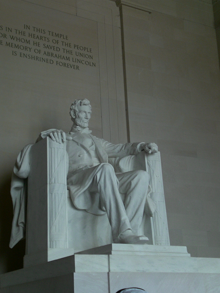
Washington, in the District of Columbia, and Baltimore, in Maryland, are grouped together as one metropolitan area that extends into northern Virginia. Baltimore is on the upper end of Chesapeake Bay, and is the inspiration for the American national anthem celebrating the local fort's endurance under British attack. The U.S. capital, Washington, sits on the fall line of the Potomac River. It boasts numerous monuments including the Capitol, the Smithsonian Castle (part of a museum), the White House (home for the national president), the Lincoln Memorial, Union Station, and the obelisk named after the nation's first president. This monument is the world's tallest obelisk and was for a time in the 19th century the world's tallest building. The Cathedral Church of St. Peter and St. Paul is the nation's second largest church, and features 110 gargoyles, one of them in the form of a stylized businessman. The Lincoln Memorial is engraved on the reverse side of the U.S. one cent coin. The National Building Museum, formerly the Pension Building, boasts a 159 foot atrium. The tallest conventional building is the late 19th century Old Post Office building, just 315 feet high--much shorter than the Washington Monument. Baltimore also boasts a Washington Monument, as well as the Emerson (or Bromo-Selzer) Tower, modeled after a building in Firenze, Italia (Florence, Italy). The 40 story Transamerica Tower is its tallest conventional building.1 Tourists also visit the city's Baltimore and Ohio Railroad Museum. The combined area's population is 8.573 million.2
The region is served by three busy airports: the Baltimore-Washington International Thurgood Marshall, the Washington Dulles International and the Ronald Reagan Washington National.3
Baltimore is a busy port for grain, containers and coal.4
| Year | Population | Political entity |
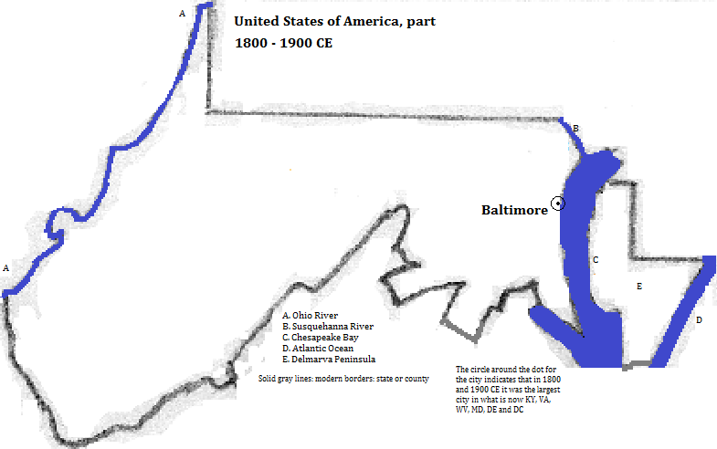
| 1800 CE | 26,0005| United States of America | |
| 1900 CE | 508,0005| United States of America | |
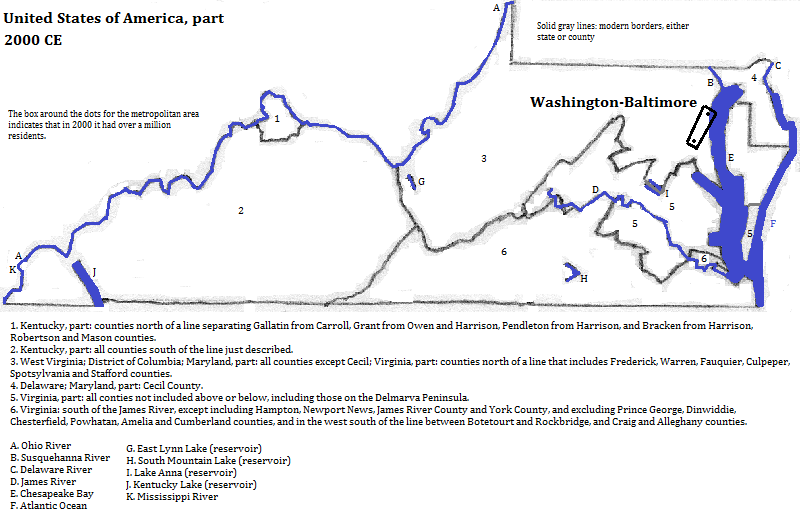
| 2000 CE | 8,573,0001| United States of America | |

Lincoln Memorial, Washington, DC
Historical maps


Footnotes
1. Details about buildings are from emporis.com, accessed 10/8/2013.
2. From http://en.wikipedia.org/wiki/Maryland_statistical_areas, accessed 9/2013.
3. http://en.wikipedia.org/wiki/List_of_the_busiest_airports_in_the_United_States
4. The Times Atlas of the Oceans (Van Nostrand Reinhold Company, 1983), "commodity loading ports" map.
5. Figure is for Baltimore only. Tertius Chandler, Four Thousand Years of Urban Growth, 2nd ed. (The Edwin Mellen Press, 1987), "Tables of World's Largest Cities". In 1800 and 1900 CE, Baltimore was the largest city in what is now Kentucky, West Virginia, Virginia, Maryland, the District of Columbia and Delaware. In 2000, the Washington-Baltimore metropolitan area was the largest in this area.


