| To Duval Family Home Page | Africa |
| To Chris Home Page | Maghreb region (the West) |
| To Earth (Geography Home Page) | الجزائر (al-Jazā'īr or Algeria) |
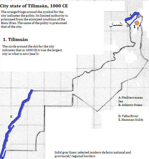
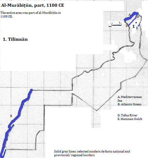
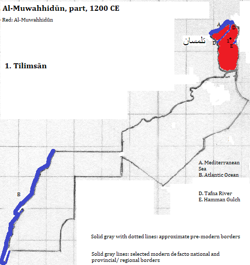
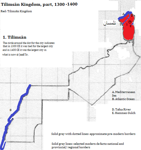
تلمسان (Tilimsān)
The city is popular with tourists for its Islamic sites.
| Name | Year | Population | Political entity |
| تلمسان (Tilimsān) | 1000 CE | city state | |
| تلمسان (Tilimsān) | 1200 CE | al-Muwahhidūn (Almohad Empire) | |
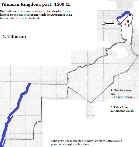
| تلمسان (Tilimsān) | 1300 CE | 50,000 | تلمسان (Tilimsān) Kingdom (Zayyanid Kingdom) |
| تلمسان (Tilimsān) | 1400 CE | 70,000 | تلمسان (Tilimsān) Kingdom (Zayyanid Kingdom) |
| تلمسان (Tilimsān) | 1500 CE | 35,000 | تلمسان (Tilimsān) Kingdom (Zayyanid Kingdom) |
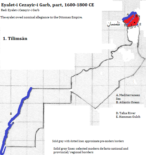
| تلمسان (Tilimsān) | 1600 CE | 40,000 | Eyalet-i Cezayir-i Garb (Regency of Algiers) |
| تلمسان (Tilimsān) | 2008 CE | 174,000 | الجزائر (al-Jazā'īr or Algeria) |
1. Tlemcen in French and English.
2. https://en.wikipedia.org/wiki/Tlemcen, accessed February 13, 2017.
3. Algérie in French; Algeria in English.
4. The city was one of the first ten listed in https://www.thecrazytourist.com/15-best-places-to-visit-in-algeria/, accessed February, 2017.
5. Tertius Chandler, Four Thousand Years of Urban Growth, 2nd ed. (The Edwin Mellen Press, 1987), "Tables of the World's Largest Cities." In 1000 and 1400 CE it was the largest city, and in 1300 it was tied for largest city, in what is now الجزائر (al-Jazā'īr). At the time it was smaller than Dumya, which waas smaller than Mahdia, which was smaller than Qus, which had a population of 45,000. In 1200 it was smaller than Meknes, which was smaller than Tunis, which was smaller than Ceuta, which had 40,000 residents, according to Chandler's 'Cities of Africa' table. The figures for 1500 and 1600 also came from the 'Cities of Africa' table.
6. The eyalet owed nominal allegiance to the Ottoman Empire.