San Francisco-San José-Oakland
San Francisco-San José-Oakland is a metropolitan area centered around San Francisco Bay. San Francisco sits at the top of the peninsula that bears its name and that separates the Pacific Ocean from the bay. One bridge connects it northward across the Golden Gate, a strait, and the other eastward across the bay to Oakland. There are hills within the city whose height approaches 300 meters. Oakland is situated due east of San Francisco along the east shore of the bay. It extends eastward into hills that reach above 500 meters. San José sprawls from the south end of the bay, along Guadalupe River and Coyote Creek, and extends into the Santa Cruz Mountains to heights above 600 meters. The metropolitan area extends through intermontane valleys and seaside communities; the immediately adjacent mountains reach 1300 meters. The Napa and Petaluma Rivers flow in from the north. To the northeast the metropolitan area ends as the extensions of San Francisco Bay transition into the Sacramento River system's delta. The metropolitan area had a population in 2012 of 7.777 million,1 with San Francisco having 865 thousand,2 San José, 1.027 million,3 and Oakland, 419 thousand.4 San Francisco gained prominence in the 19th century as the port city supporting the gold extraction industry east of the city. It and nearby cities grew further during World War II.
San Francisco's tallest building is the Transamerica Pyramid (853 feet, 1972). 555 California, the former headquarters of Bank of America, was the city's tallest from 1969 to 1972 (779 feet). The Golden Gate Bridge (1937) is nearly as high and is a tourist attraction.5 Other notable buildings include: the City Hall, with a rotunda that is taller than that of the Capitol in Washington; the Ferry Building (1898); Coit Tower (1934); Fort Point (a former fort, 1861); and the Old U.S. Mint that in 1934 held one-third of the national gold reserves. Oakland's City Hall (1914) and San José's Hotel De Anza (1931) are also notable.6 Just east of San José is the mountain-top Lick Observatory (1887).
Next to the town of Rio Vista at the eastern edge of the metropolitan area is the Rio Vista Gas Field.7
Three major airports serve the area: San Francisco International, located south of the city along the bay; Oakland International within the city on a former bay island; and the Norman Y. Mineta San José International located just south of the bay.8
Oakland is a major container port.9
| Year | Population | Political entity |
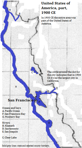
| 1900 CE | 439,00010| United States of America | |
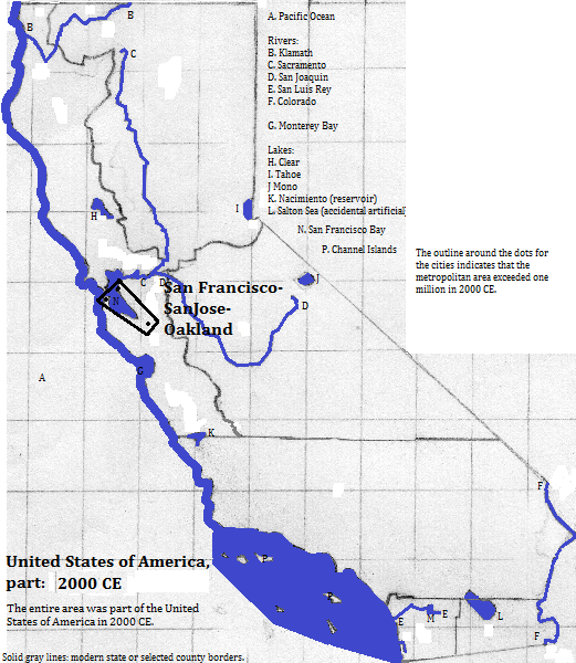
| 2000 CE | 7,039,00011| United States of America | |
Historical Maps


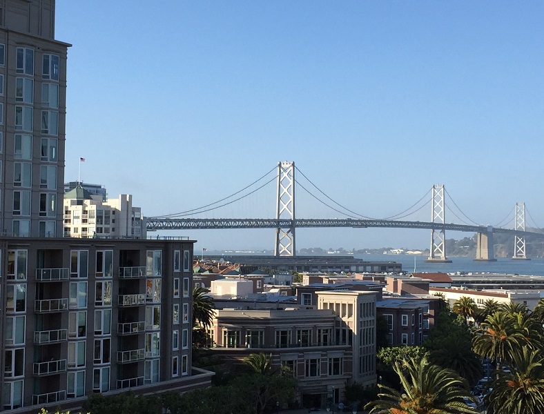
View from AT&T Park of part of San Francisco including the western portion of the San Francisco-Oakland Bay Bridge
Footnotes
1. Calculation in world-gazetteer.com, acceessed February 6, 2013.
2. 2015 estimate from the side banner of https://en.wikipedia.org/wiki/San_Francisco, accessed January 30, 2017, which cites http://factfinder2.census.gov/bkmk/table/1.0/en/PEP/2015/PEPANNRES/0400000US06.05000.
3. 2014 figure from the side banner of https://en.wikipedia.org/wiki/San_Jose,_California, accessed January 30, 2017.
4. 2015 estimate from the side banner of https://en.wikipedia.org/wiki/Oakland,_California, accessed January 30, 2017, which cites http://www.census.gov/popest/data/cities/totals/2015/SUB-EST2015.html.
5. http://www.touropia.com/tourist-attractions-in-california/#, accessed December 26, 2016.
6. Information about buildings is from emporis.com, accessed January 30, 2017. The Sutro Tower, a framed mast, is San Francisco's tallest structure (981 feet).
7. https://en.wikipedia.org/wiki/List_of_natural_gas_fields, accessed December 26, 2016.
8. 45 busiest US airports by total passenger traffic (2014) table in https://en.wikipedia.org/wiki/List_of_the_busiest_airports_in_the_United_States, accessed December 26, 2016.
9. Alastair Cooper, ed., The Times Atlas of the Oceans (Van Nostrand Reinhold Company, 1983), "commodity loading ports" map.
10. Tertius Chandler, Four Thousand Years of Urban Growth, 2nd ed. (The Edwin Mellen Press, 1987), "Tables of the World's Largest Cities." In 1900 it was the largest city in California.
11. Metropolitan figure from https://www.census.gov/population/www/cen2000/briefs/phc-t3/tables/tab03.txt, accessed December 26, 2016.


