قسنطينة (Qusanṭīnah)
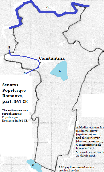
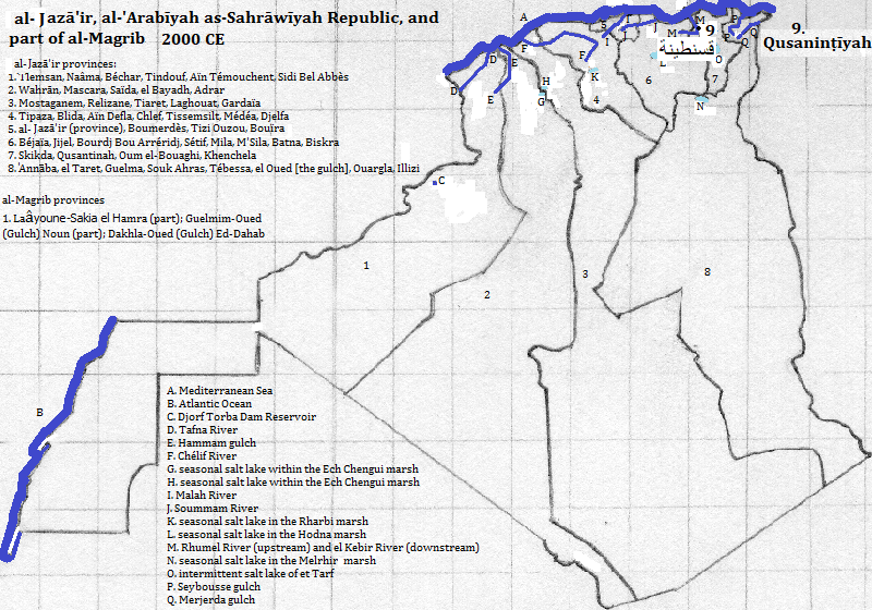
قسنطينة (Qusanṭīnah)1 had a population of 448 thousand in 2008 with 938 thousand in the metropolitan area.2 It is located about 80 kilometers inland, on a deeply cut plateau, more than 600 meters above sea level, along the Rhumel River, a tributary of the el Kebir River in a province bearing its name, in الجزائر (al-Jazā'īr).3 It rose to prominence as the capital of the united kingdom of the Massylyii and the subordinate Masaesyli confederations in the late third century BCE. It later became part of Senatvs Popvlvsqve Romanvs (Roman Republic and Empire). In the fourth century CE, it was destroyed during a civil war, and was rebuilt under the name Constantina. When the area was conqured by the 'Arabs in the seventh century they gave it its current name. It was called Constantine when the French ruled it.
The tallest building is the Administration Tower of Metouri University (255 feet), although the framed mast of the Djebel Ouash Radio Tower is taller 328 feet.4
The city is popular with tourists, both for its modern and its classical architecture.5
| Name | Year | Population | Political entity |
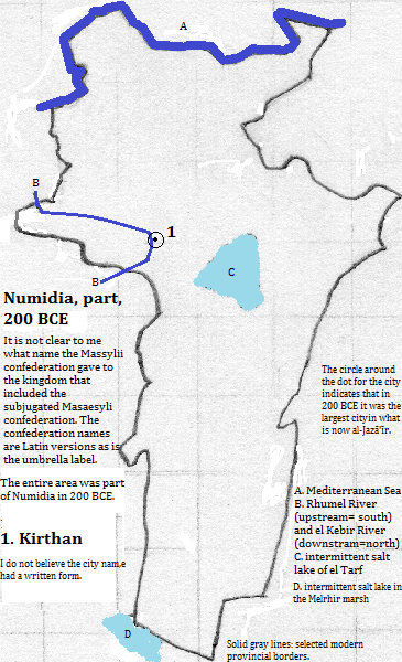
| Kirthan6 | 200 BCE | 7 | Numidia8 |
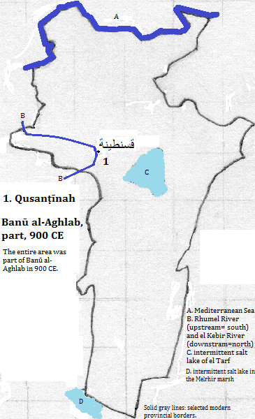
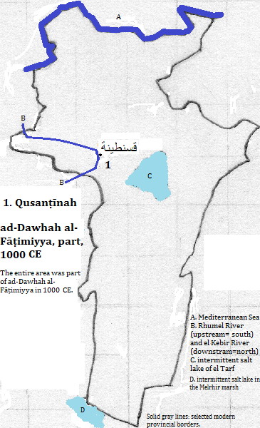
| قسنطينة (Qusanṭīnah) | 1000 CE | 7 | ad-Dawhah al-Fāṭimiyya |
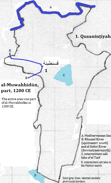
| قسنطينة (Qusanṭīnah) | 1200 CE | 7 | al-Muwahhidūn (Almohad Empire) |
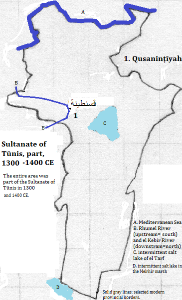
| قسنطينة (Qusanṭīnah) | 1300 CE | 7 | Sultanate of Tūnis (Hafasid Kingdom) |
| قسنطينة (Qusanṭīnah) | 1400 CE | 30,0007 | Sultanate of Tūnis (Hafasid Kingdom) |
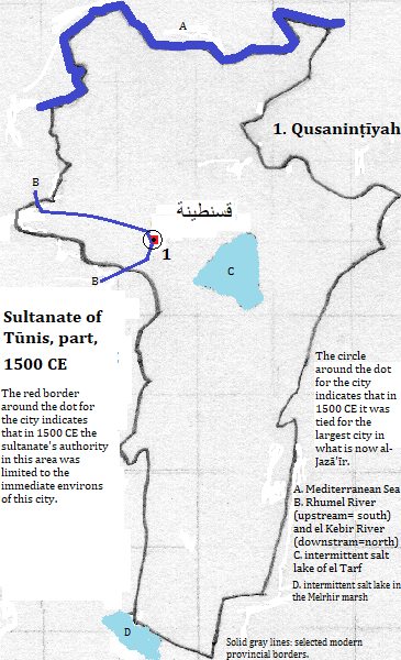
| قسنطينة (Qusanṭīnah) | 1500 CE | 40,0007 | Sultanate of Tūnis (Hafasid Kingdom) |
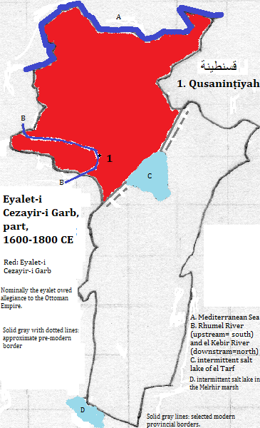
| قسنطينة (Qusanṭīnah) | 1600 CE | 40,0007 | Eyalet-i Cezayir-i Garb (Regency of Algiers)9 |
| قسنطينة (Qusanṭīnah) | 1700 CE | 30,0007 | Eyalet-i Cezayir-i Garb (Regency of Algiers)9 |
| قسنطينة (Qusanṭīnah) | 1800 CE | 25,0007 | Eyalet-i Cezayir-i Garb (Regency of Algiers)9 |
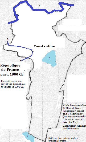
| Constantine | 1800 CE | 52,0007 | République de France |
| قسنطينة (Qusanṭīnah) | 2008 CE | 938,000 (metropolitan)2 | الجزائر (al-Jazā'īr or Algeria) |
External references
Bridges over the city of Qusanṭīnah, al-Jazā'īr
Historical maps


Footnotes
1. Constantine in French and English.
2. https://en.wikipedia.org/wiki/Constantine,_Algeria, accessed February, 2017.
3. Algérie in French; Algeria in English.
4. emporis.com, accessed March 13, 2017.
5. The city was one of the first ten listed in https://www.thecrazytourist.com/15-best-places-to-visit-in-algeria/, accessed February, 2017.
6. I do not believe that Kirthan had a written form.
7. According to Tertius Chandler, Four Thousand Years of Urban Growth, 2nd ed. (The Edwin Mellen Press, 1987), "Tables of the World's Largest Cities," in 200 BCE Kirthan had a population smaller than Ephesus (which had 40 thousand) and greater than Lucheng, which was greater than Peshawar, which was greater than Changsha, which had 38 thousand. In 200 BCE it was the largest city in what is now الجزائر (al-Jazā'īr). In 1000 CE قسنطينة (Qusanṭīnah) was smaller than تلمسان (Tilimsān), which was smaller than Dumya, which was smaller than Mahdi, which was smaller than Qus, which had 45 thousand inhabitants. In 1200 it was smaller than تلمسان (Tilimsān), which was smaller than Meknes, which was smaller than Tunis, which as smaller than Ceuta, which had 40,000 residents according to Chandler's 'Cities of Africa' table. In 1300 it was smaller than Mahdi, which was sale than Salé, which had 40 thousand residents according to Chandler's 'Cities of Africa' table. The figures for 1400, 1600 and 1700 came from the 'Cities of Africa' table, as did that for 1500 when it was tied for the largest city in what is now الجزائر (al-Jazā'īr). The figures for 1800 and 1900 are from his "Tables of the World's Largest Cities."
8. I do not know the local contemporanous name of the united kingdom of the Massylyii and the subordinate Masaesyli confederations.
9. Nominally the eyalet owed allegiance to the Ottoman Empire.