New Orleans
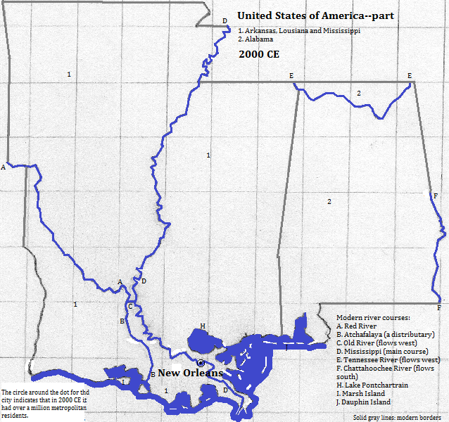
New Orleans is in the coastal delta of the Mississippi, between the river and Lake Pontchartrain. The city is an important port but is most famous for inventing the musical style of jazz in the late 19th and early 20th century. It had a metropolitan population of 1.069 million in 2006.1 Tourists enjoy the French Quarter and the Mardi Gras Festival. The tallest building is One Shell Square, a 51 story building from 1972 and mimicking a same-named building in Houston. Its predecessors for tallest were: the Plaza Hotel from 1969 to 1972 with its protruding cap; the cross-shaped 33 story World Trade Center from 1967 to 1969; the 20 story Capital One Bank Building from 1921 to 1967, which also served as a navigational lighthouse; the 14 story Whitney National Bank Building from 1909 to 1921; the 13 story Hampton Inn New Orleans Downtown from 1904 to 1909; the 11 story (originally 10 story) Latter & Blum building from 1895 to 1904; and the 8 story Best Western St. Christopher Hotel 1893 to 1895. Other famous buildings include: the Medical Center of Louisiana Charity Hospital, which took over the functions of an 18th century hospital; the 72 thousand seat Superdome, primarily for use by gridiron football; the St. Louis Cathedral finished in 1851; and the Jackson Brewery.2
New Orleans is a major grain and coal port.3
| Year | Population | Political entity |
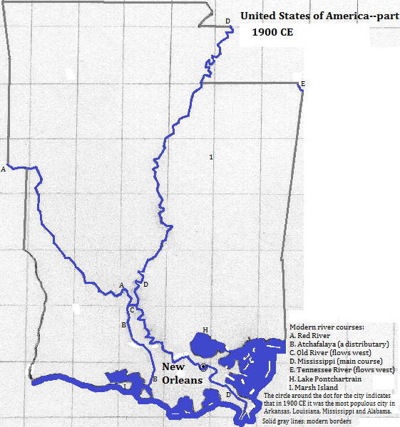
| 1900 CE | 291,0004| United States of America | |
| 2006 CE | 1,069,0001| United States of America | |
External references
Skyline of New Orleans behind the Mississippi River, Louisiana, USA
Historical maps


Footnotes
1. http://en.wikipedia.org/wiki/Louisiana_statistical_areas, accessed 3/19/2014.
2. Information about buildings is from emporis.com, accessed 4/8/2014. The hospital may be torn down due to hurricane damage.
3. The Times Atlas of the Oceans (Van Nostrand Reinhold Company, 1983), "commodity loading ports" map.
4. Tertius Chandler, Four Thousand Years of Urban Growth, 2nd ed. (The Edwin Mellen Press, 1987), "Tables of World's Largest Cities." In 1900 it was the largest city in the combined area of Alabama, Mississippi, Arkansas and Louisiana.

