| To Duval Family Home Page | Africa |
| To Chris Home Page | Angola |
| To Earth (Geography Home Page) |
North
Tourists visit Dala Waterfalls.
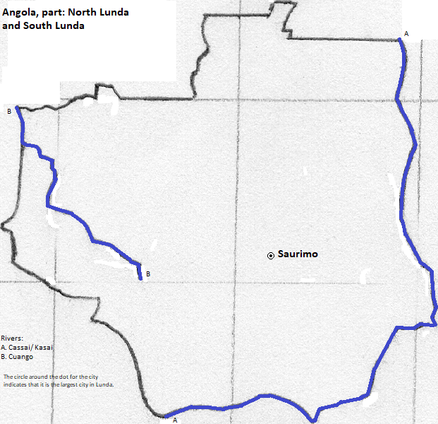
Less than half a million people live here. About two-thirds of them speak Chokwe, more than three in ten Ruund
There are no large cities, and neither of the two principle capitals predominates. Camaquenzo Airport serves the northern capital of Dundo (2010 population of 40,000) and Saurimo Airport serves the southern capital of Saurimo (2010 population of 78,000).
Bantu languages moved into the area in the last two millennia. The Ruund people, centered in Katanga, created an empire in the 17th century. They conquered people south of them who called both themselves and the Ruund 'Lunda,' and so the empire is known by that name. The Chokwe expanded northward in the 19th century and took over the former empire, absorbing large numbers of enslaved women and thus coming into regional linguistic hegemony.
northeast
east
south
southwest
west
northwest
1. Norte in Portuguese
2. Sul in Portuguese
3. Or Congo River. The Congo is most narrowly the name of its lower course and the Zaïre of its middle course.
4. Called the Kasai in the Democratic Republic of Congo. Its downstream end there is called the Kwa.
5. Called the Kwango in the Democratic Republic of Congo.
6. Called the Loange in the Democratic Republic of Congo.
7. Called the Kwilu in the Democratic Republic of Congo.
8. https://www.thecrazytourist.com/15-best-places-to-visit-in-angola, accessed December 22, 2018.
9. Also called Northern Lunda.
10. Also called Southern Lunda.
11. Due to external displacements in both directions, these proportions are tentative.
12. The source for information about the Chokwe religion is www.uiowa.edu/~africart/toc/people/Chokwe.html, accessed May 26, 2007.
13. https://en.wikipedia.org/wiki/List_of_cities_and_towns_in_Angola, accessed December 22, 2018.
14. Regularly scheduled service on a commericial airline, in https://en.wikipedia.org/wiki/List_of_airports_in_Angola, accessed December 22, 2018.