| To Duval Family Home Page | Africa |
| To Chris Home Page | To Earth (Geography Home Page) |
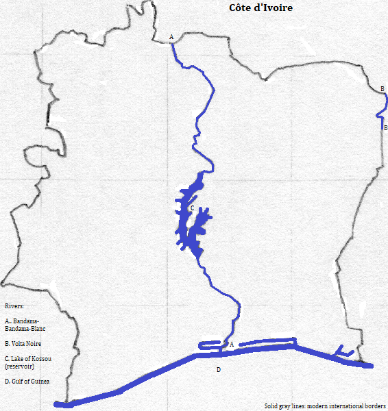
The broad coastal plain of Côte d'Ivoire
The Cavally
There are three UNESCO World Heritage sites that recognize nature: Comoé National Park; Mount Nimba Strict Nature Reserve, which is partially in Guinée;

No-one first language amounts to a majority of the 19.6 million people. Together the Atlantic-Congo group accounts for more than two-thirds; exactly how much more is difficult to say due to the millions of immigrants from neighboring countries.
The majority practice local traditional religions. These are described as animist due to the belief that spirits are associated with places or deceased ancestors, and that these spirits are relevant to happenings in the material world. Thus the Baule think many adults have a spouse from the blolo (the beyond) who can influence their lives, and--among the Senoufo--blacksmiths are thought exempt from evil spirits and thus play key funerary roles. Aspects of these religions can be glimpsed from artifacts and ceremonies. The masks of the Dan are consulted to forecast events like harvest yield. The Baule's kplekple mask is said to represent a forest demon, and the Senufo's fire-spitter helmet mask is said to memorialize the primeval chaos. The spiritual content of juggling young girls can be seen, less from the spectacle, than from the elaborate preparation of the children. And the stilt dancing--also practiced by the Dan--is said to be guided by spirits.
Around one in four citizens are Moslems: mostly in the north and among traders and weavers elsewhere. Christians, mostly Roman Catholics, amount to more than one in ten.
Cities include Abidjan, and several cities that are tourist destinations:
The Baoule preserve a tradition of migrating from Ghana in 1750. The Kru groups are said to have come from the west about 1600. Dyula is an offshoot of Mandekan, the language of the former Mali Empire. Its prestige assisted it to become the lingua franca of local traders, spreading Islam with it. The Senoufo are also said to have migrated from the north. The French conquered the area starting in the 1840s, introducing Roman Catholic Christianity. The long-ruling dictator, Houphouet-Boigny retained favor for the colonial language and religion.
north, from the northwest
north, from the northeast
east
south
west, from the southwest
west, from the northwest
1. Ivory Coast. The government has forbidden its translation into English.
2. Also called the Cavalla, or by its tributary's names: the Douobe or Dube.
3. Also called the Blanc (white) Bandama, after the river.
4. White and Red in English.
5. Also spelled Comoé.
6. Guinea in English.
7. https://www.thecrazytourist.com/15-best-places-visit-ivory-coast/, accessed February 14, 2018.
8. Some of the 'immigrants' are child-slaves, abducted or lured, working the cocoa plantations. Their precarious status and short lives makes linguistic and religious information about them sparse.
9. Also called Baoule, and including Anyin and Nzema. It is also an important second language.
10. Or Yacouba.
11. Or Jula or Dioula.
12. https://www.thecrazytourist.com/15-best-places-visit-ivory-coast/, accessed February 14, 2018.
13. 2005 figures from https://en.wikipedia.org/wiki/List_of_cities_in_Ivory_Coast, accessed February 14, 2018.
14. 2017 figure from http://www.demographia.com/db-worldua.pdf, downloaded February 14, 2018.