| To Duval Family Home Page | Africa |
| To Chris Home Page | Maghreb region (the West) |
| To Earth (Geography Home Page) | الجزائر (al-Jazā'īr or Algeria) |
بجاية (Bijāyah)
The city is served by the Soumman-Albane Ramdane Airport, one of the nation's busiest.
The oil port is of world importance.
| Name | Year | Population | Political entity |
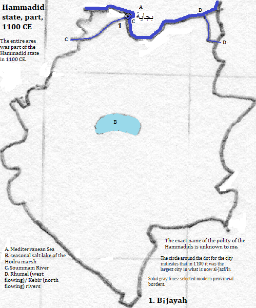
| بجاية (Bijāyah) | 1100 CE | 50,000 | Hammadid state |
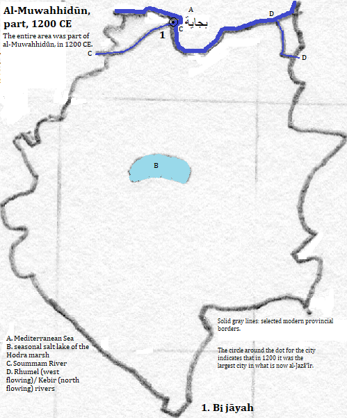
| بجاية (Bijāyah) | 1200 CE | 50,000 | al-Muwahhidūn (Almohad Empire) |
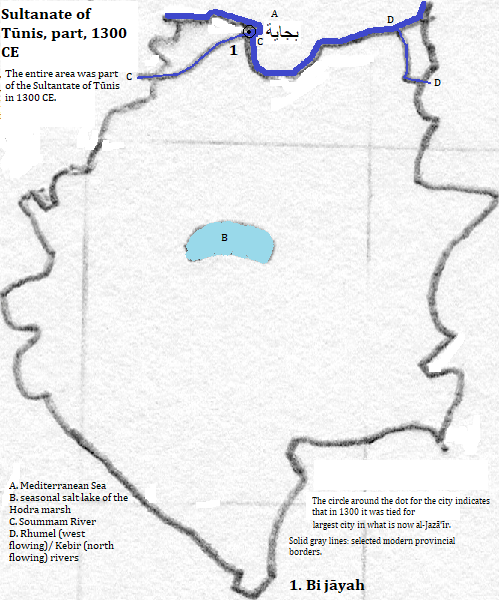
| بجاية (Bijāyah) | 1300 CE | 50,000 | Sultanate of Tūnis (Hafsid Kingdom) |
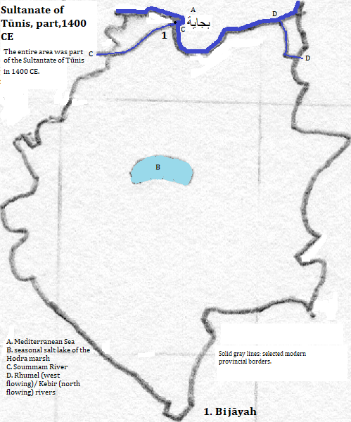
| بجاية (Bijāyah) | 1400 CE | 40,000 | Sultanate of Tūnis (Hafsid Kingdom) |
| بجاية (Bijāyah) | 1500 CE | 40,000 | city state |
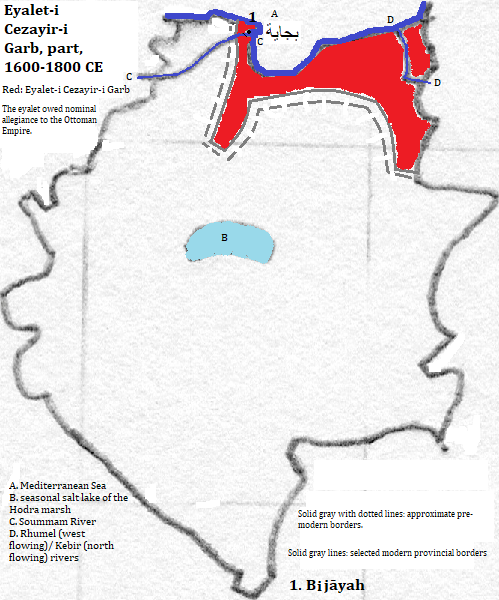
| بجاية (Bijāyah) | 1600 CE | 40,000 | Eyalet-i Cezayir-i Garb (Regency of Algiers) |
| بجاية (Bijāyah) | 2008 CE | 176,000 | الجزائر (al-Jazā'īr or Algeria) |

1. Béjaïa in French and formerly Bougie in French and English.
2. https://en.wikipedia.org/wiki/B%C3%A9ja%C3%AFa, accessed February 13, 2017.
3. Algérie in French; Algeria in English.
4. https://en.wikipedia.org/wiki/List_of_the_busiest_airports_in_Algeria, accessed February 13, 2017; my criterion for importance was more than 100,000 annual passengers. The table covered 2008.
5. The Times Atlas of the Oceans (Van Nostrand Reinhold Company, 1983), "commodity loading ports" map.
6. Tertius Chandler, Four Thousand Years of Urban Growth, 2nd ed. (The Edwin Mellen Press, 1987), "Tables of the World's Largest Cities." In 1100 and 1200 CE it was the largest city, and in 1300 and 1500 it was tied for largest city, in what is now الجزائر (al-Jazā'īr). The figures for 1400, 1500 and 1600 come from his 'Cities of Africa' table.
7. I do not know the formal name of the polity.
8. The eyalet owed nominal allegiance to the Ottoman Empire.