| To Duval Family Home Page | Africa |
| To Chris Home Page | Maghreb region (the West) |
| To Earth (Geography Home Page) | الجزائر (al-Jazā'īr or Algeria) |
The city of الجزائر (al-Jazā'īr)
| Name | Year | Population | Political entity |
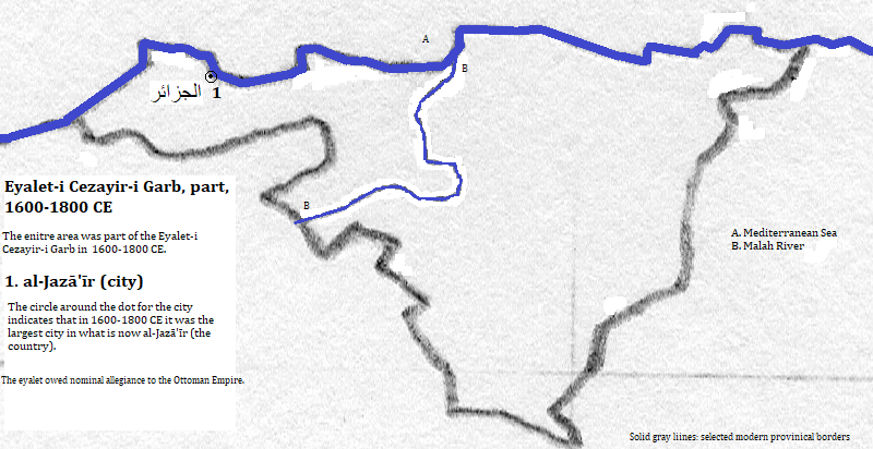
| الجزائر (al-Jazā'īr) | 1600 CE | 75,000 | Eyalet-i Cezayir-i Garb (Regency of Algiers) |
| الجزائر (al-Jazā'īr) | 1700 CE | 85,000 | Eyalet-i Cezayir-i Garb (Regency of Algiers) |
| الجزائر (al-Jazā'īr) | 1800 CE | 73,000 | Eyalet-i Cezayir-i Garb (Regency of Algiers) |
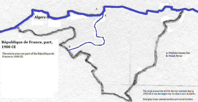
| Algers | 1900 CE | 140,000 | République de France |
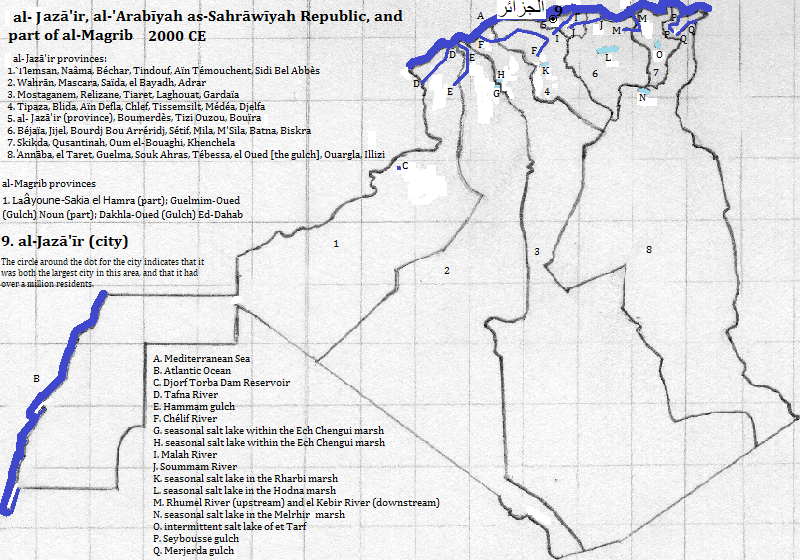
| الجزائر (al-Jazā'īr) | 2012 CE | 7,081,000 metropolitan | الجزائر (al-Jazā'īr or Algeria) |
1. Called Algers in French and Algiers in English.
2. Called Algerie in French and Algeria in English.
3. 2011 figure from the side bar of https://en.wikipedia.org/wiki/Algiers, accessed September 24, 2017.
4. 2012 figure from world-gazetteer.com, accessed February 6, 2013. It is the largest metropolitan area in the nation of الجزائر (al-Jazā'īr).
5. Emporis.com, accessed September 24, 2017.
6. https://en.wikipedia.org/wiki/List_of_the_busiest_airports_in_Algeria, accessed February 13, 2017; my criterion for importance was more than 100,000 annual passengers. The table covered 2008.
7. According to the main body of https://en.wikipedia.org/wiki/Dar_El_Be%c3%AFda, accessed February 13, 2017.
8. The city's Islamic sites comprised one of the first ten attractions listed in https://www.thecrazytourist.com/15-best-places-to-visit-in-algeria/, accessed February, 2017.
9. Tertius Chandler, Four Thousand Years of Urban Growth, 2nd ed. (The Edwin Mellen Press, 1987), "Tables of the World's Largest Cities." In 1600, 1700, 1800 and 1900 it was the largest city in what is now the nation of الجزائر (al-Jazā'īr).
10. The eyalet owed nominal allegiance to the Ottoman Empire.