To Duval Family Home Page Africa
To Chris Home Page Maghreb region (the West)
To Earth (Geography Home Page) الجزائر (al-Jazā'īr or Algeria)

عنابة ('Annābah)

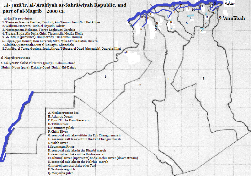
عنابة ('Annābah)1 had a population of 257 thousand in 2008 with 360 thousand in the metropolitan area in 1998.2 It is located along the Mediterranean Sea coast, near the Seybousse River, in a province bearing its name, in الجزائر (al-Jazā'īr).3 It rose to prominence by the fourth century CE as an important colonia (settler city) and port within the Senatvs Popvlvsqve Romanvs (Roman Republic and Empire). When the area was conqured by the 'Arabs in the seventh century they gave it its current name. It was called Bône when the French ruled it.

The tallest buildings are the seven Zaafrania residential towers (about 219 feet, 2015).4

The remains of Roman Hippo, in the southern reaches of the city, are popular with tourists.5

The city is an important ore port.6

NameYearPopulationPolitical entity
Hippo361 CE40,0007Senatvs Popvlvsqve Romanvs (Roman Empire)
عنابة ('Annābah)1998 CE360,0002 الجزائر (al-Jazā'īr or Algeria)

External references

overview of 'Annābah, al-Jazā'īr

Historical maps

map of 'Annāba, el Taret, Guelma, Souk Ahras, Tébessa, Oued (Gulch) Quargla, and Illizi provinces of al-Jazā'īr (Algérie or Algeria), 361 CE

map of 'Annāba, el Taret, Guelma, Souk Ahras, Tébessa, Oued (Gulch) Quargla, and Illizi provinces of al-Jazā'īr (Algérie or Algeria), 500 CE

map of 'Annāba, el Taret, Guelma, Souk Ahras, Tébessa, Oued (Gulch) Quargla, and Illizi provinces of al-Jazā'īr (Algérie or Algeria), 622 CE

map of 'Annāba, el Taret, Guelma, Souk Ahras, Tébessa, Oued (Gulch) Quargla, and Illizi provinces of al-Jazā'īr (Algérie or Algeria), 800 CE

map of 'Annāba, el Taret, Guelma, Souk Ahras, Tébessa, Oued (Gulch) Quargla, and Illizi provinces of al-Jazā'īr (Algérie or Algeria), 900 CE

map of 'Annāba, el Taret, Guelma, Souk Ahras, Tébessa, Oued (Gulch) Quargla, and Illizi provinces of al-Jazā'īr (Algérie or Algeria), 1000 CE

map of 'Annāba, el Taret, Guelma, Souk Ahras, Tébessa, Oued (Gulch) Quargla, and Illizi provinces of al-Jazā'īr (Algérie or Algeria), 1100 CE

map of 'Annāba, el Taret, Guelma, Souk Ahras, Tébessa, Oued (Gulch) Quargla, and Illizi provinces of al-Jazā'īr (Algérie or Algeria), 1200 CE

map of 'Annāba, el Taret, Guelma, Souk Ahras, Tébessa, Oued (Gulch) Quargla, and Illizi provinces of al-Jazā'īr (Algérie or Algeria), 1300-1400 CE

map of 'Annāba, el Taret, Guelma, Souk Ahras, Tébessa, Oued (Gulch) Quargla, and Illizi provinces of al-Jazā'īr (Algérie or Algeria), 1500 CE

map of 'Annāba, el Taret, Guelma, Souk Ahras, Tébessa, Oued (Gulch) Quargla, and Illizi provinces of al-Jazā'īr (Algérie or Algeria), 1600-1800 CE

map of 'Annāba, el Taret, Guelma, Souk Ahras, Tébessa, Oued (Gulch) Quargla, and Illizi provinces of al-Jazā'īr (Algérie or Algeria), 1900 CE

map of al-Jazā'īr (Algérie or Algeria) 2000 CE, showing 'Annāba

Footnotes

1. Annaba in English.
2. https://en.wikipedia.org/wiki/Annaba, accessed February, 2017.
3. Algérie in French; Algeria in English.
4. emporis.com, accessed April 7, 2017.
5. The city was one of the first ten listed in https://www.thecrazytourist.com/15-best-places-to-visit-in-algeria/, accessed February, 2017.
6. The Times Atlas of the Oceans (Van Nostrand Reinhold Company, 1983), "commodity loading ports" map.
7. Tertius Chandler, Four Thousand Years of Urban Growth, 2nd ed. (The Edwin Mellen Press, 1987), "Tables of the World's Largest Cities." In 361 CE it was the largest city in what is now الجزائر (al-Jazā'īr).