Paris
Paris, the capital of France, has 12.076 million people in its metropolitan area in 2012,1 with 2.125 million in the city proper in 1999.2 It is located on the Seine River, centered on an island. UNESCO honors much of the city as a World Heritage Site called 'Paris, Banks of the Seine.' This includes the Tower of Eiffel, Hôtel (hall) of the Invalides, the Notre-Dame cathedral, la Sainte Chapelle, the Place (plaza) de la Concorde and the Louvre museum housed in a former castle.3 The church of Saint-Jacques-de-la-Boucherie is part of a UNESCO site honoring the pilgimage routes of Santiago de Compostela.4 The Tower of Eiffel is the tallest building5 and a tourist attraction.6 The palace at Versailles7 is a UNESCO site and a tourist attraction.6 The one-time royal grounds, developed particulary under Louis XIV includes the palace, the two Trianons, the Orangerie and gardens.3 In the town of Fountainebleau are a palace and park that constitutes another UNESCO World Heritage Site. This was originally a hunting lodge but it was enlarged and enhanced from 1528 until the 19th century.3 Other monuments and buildings include a conglomeration of five modern towers of unequal height called the Tour (tower) Total (in Courbevoie8 and part of La Défense business complex), the Grand Palais (literally, the Great Palace; an exhibition hall from 1900), the neo-classical Arc de Triomphe, the Sacré-Cœur Basilica, the square-cornered Grande Arche in the business district, the Opéra Garnier, the Georges Pompidou Center and the Hôtel de Ville (City Hall).
The metropolitan area is served by two of the nation's busiest airports: Paris-Charles-de-Gaulle (located in Tremblay-en-France9 and other communes) and Paris-Orly (located in Athis-Mons,10 Orly11 and other communes).
Several important mathematicians flourished in Paris; D'Alembert and Cauchy were also born there. Girard Desargues wrote on projective geometry in the Brouillon projet, (1639) and though not immediately accepted it later influenced others. Desargues was also an architect, engineer and music theorist. Blaise Pascal is most famous for the theorem that the pairs of opposite sides of a hexagon inscribed in a conic section meet in three collinear points, but he made many other contributions to mathematics, as well as to physics and literature. In 1645 he built one of the world's first computers. Jean le Rond d'Alembert is known in part for his work with complex numbers, as well as his contributions to physics and to the Encylopédie of the 18th century. Augustin-Louis Cauchy is best known for his theorem named after him (developed 1814, published 1825).12
The city was formerly also called Parisivs when Latin was used in administration.
| Year | Population | Political entity |
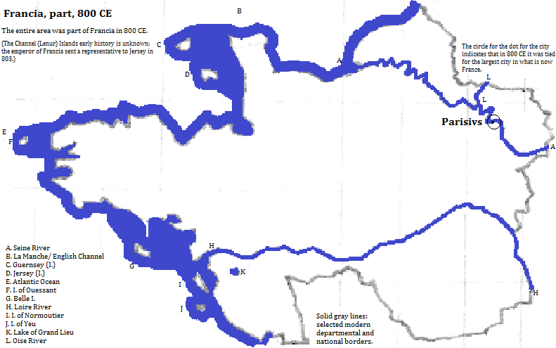
| 800 CE | 25,00013 | Francia (Frankish Empire) |
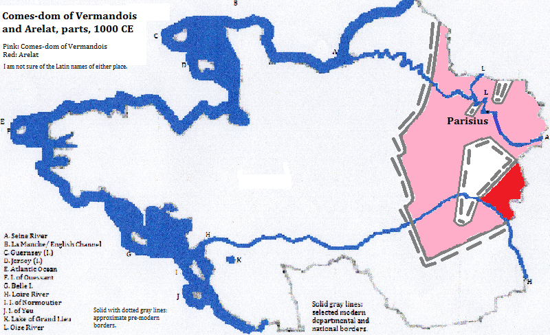
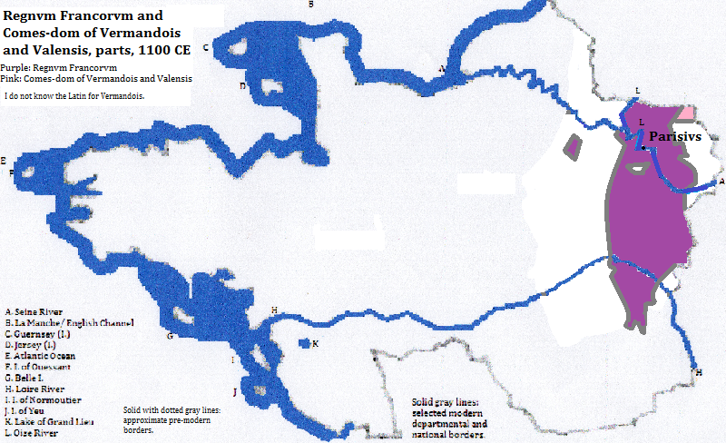
| 1000 CE | 20,00013 | Comes-dom (County) of Vermandois14 |
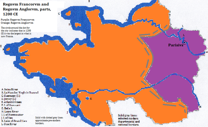
| 1200 CE | 110,00015 | Regnvm Francorvm (France) |
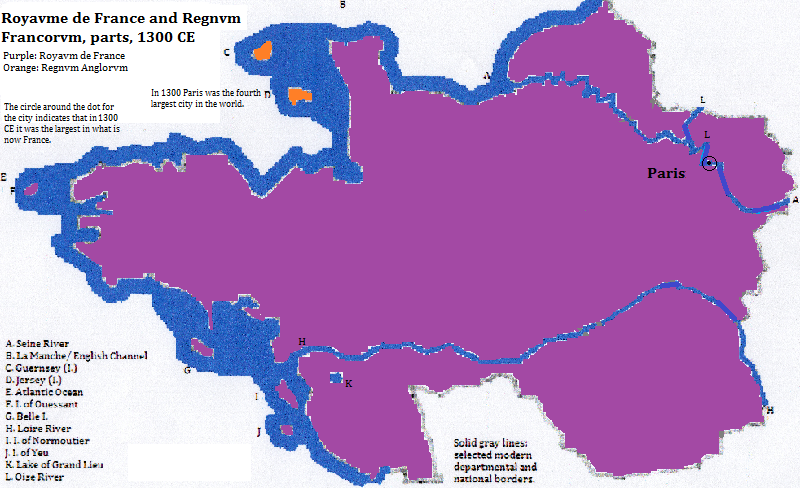
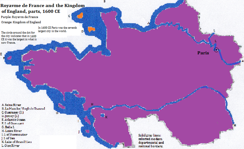
| 1300 CE | 228,00015 | Royavme de France |
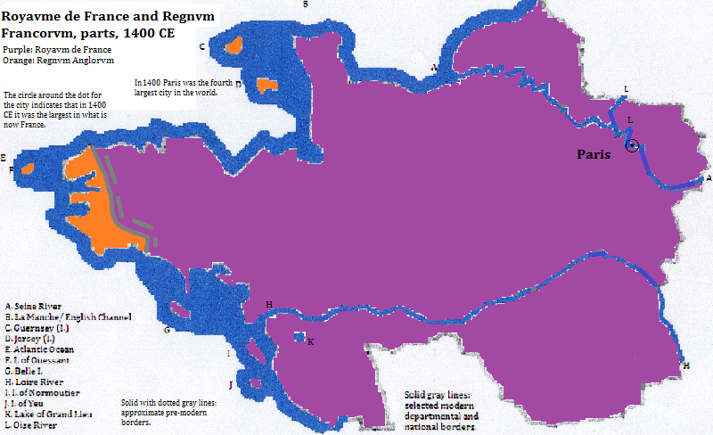
| 1400 CE | 280,00015 | Royavme de France |
| 1500 CE | 185,00015 | Royavme de France |
| 1600 CE | 245,00015 | Royaume de France |
| 1700 CE | 530,00015 | Royaume de France |
| 1800 CE | 547,00015 | République de France |
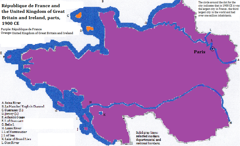
| 1900 CE | 3,300,00015 | République de France |
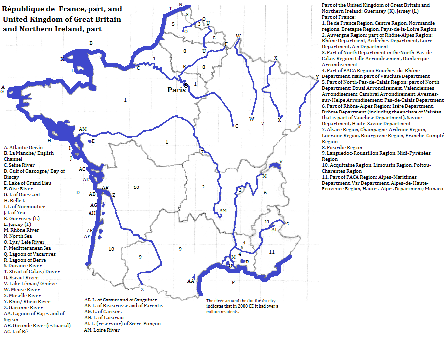
| 2012 CE | 12,076,0001 | République de France |
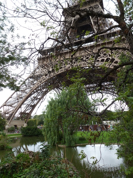
The Tower of Eiffel, Paris, France
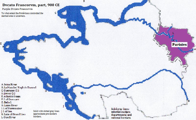
Historical maps


Footnotes
1. World-gazetteer.com, accessed 2/6/2013.
2. http://simple.wikipedia.org/wiki/List_of_cities_in_France, accessed 2/5/2015.
3. UNESCO, World Heritage Sites (Firefly Books, 2010).
4. From the list in http://en.wikipedia.org/wiki/World_Heritage_Sites_of_the_Routes_of_Santiago_de_Compostela_in_France, accessed 2/8/2015.
5. Emporis.com, accessed 4/7/2015.
6. http://www.touropia.com/tourist-attractions-in-france/, accessed 2/9/2015.
7. Versailles had a population of about 86 thousand in 2010 according to http://en.wikipedia.org/wiki/List_of_communes_in_France_with_over_20,000_inhabitants, accessed 2/5/2015.
8. Courbevoie had a population of about 86 thousand in 2006 according to the side banner of http://en.wikipedia.org/wiki/Courbevoie, accessed 4/7/2015.
9. Tremblay-en-France had a population of about 36 thousand in 2006 according to the side banner of http://en.wikipedia.org/wiki/Tremblay-en-France, accessed 4/7/2015.
10. Athis-Mons had a population of about 31 thousand in 2005 or 2006 according to the side banner of http://en.wikipedia.org/wiki/Athis-Mons, accessed 4/7/2015.
11. Orly had a population of about 21 thousand in 2007 according to the side banner of http://en.wikipedia.org/wiki/Orly,_France, accessed 4/7/2015.
12. Information about mathematicians comes from John Stillwell, Mathematics and its History (2nd ed., Springeer, 2002).
13. Cities of Europe, [800, 1000] A.D., in Tertius Chandler, Four Thousand Years of Urban Growth, 2nd ed. (The Edwin Mellen Press, 1987). In 800 CE it was tied for largest city in what is now France. From 1200 on (and perhaps earlier) it was in undisputed first place there. In 1300 and 1400 it was the fourth largest city in the world, and in 1500 it was eighth, 1600 seventh, 1700 fifth, 1800 sixth and 1900 third.
14. I do not know the Latin for Vermandois.
15. Tables of the Worlds Largest Cities, Ibid.