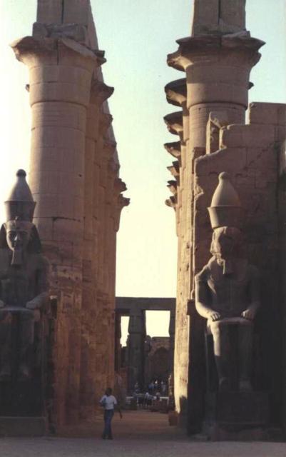
Luxor Temple with dual statues
| To Duval Family Home Page | Africa | |
| To Chris Home Page | Eastern Egypt | |
| To Earth (Geography Home Page) | Miṣr (Egypt) |
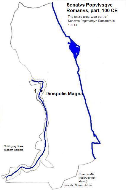
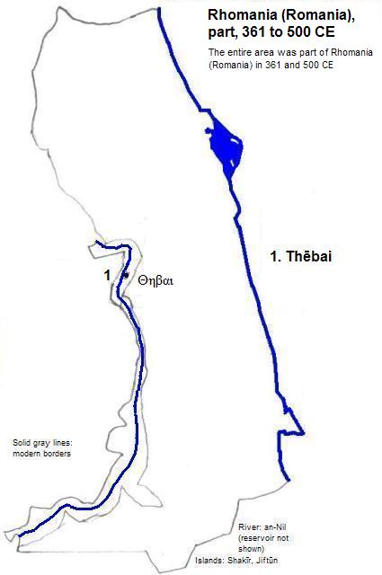
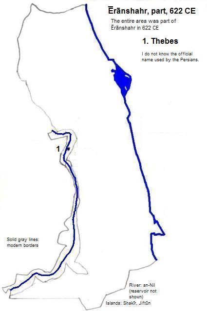
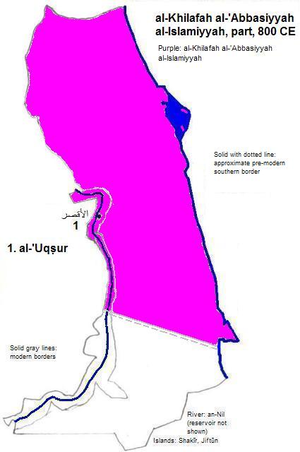
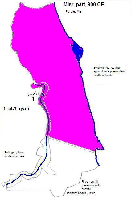
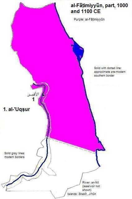
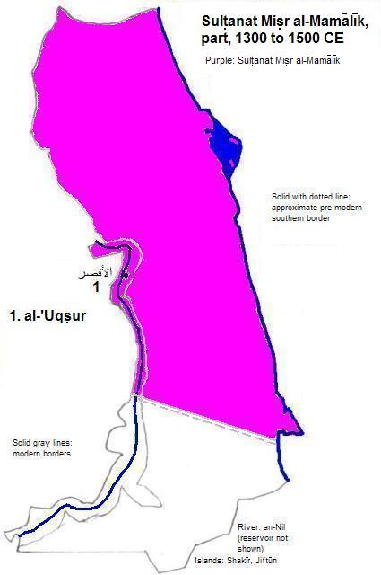
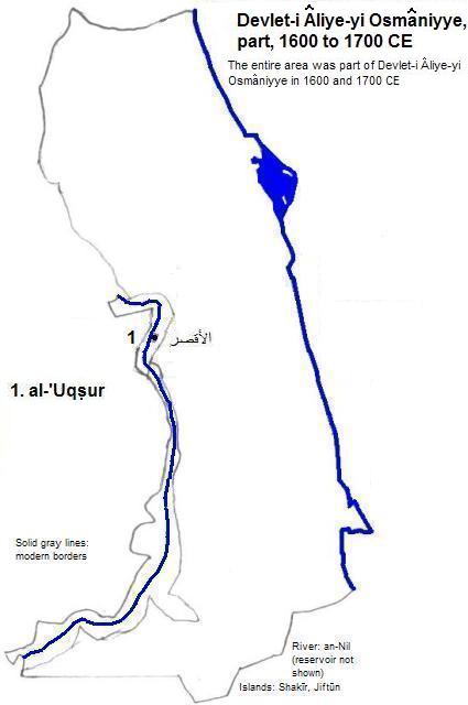
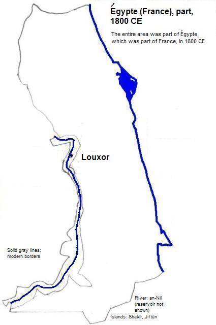
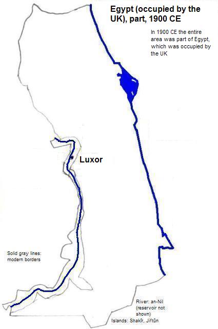
الأقصر (al-,'Uqṣur or Louxor or Luxor) is on the right bank of the Nile, south of a large bend but well north of the first cataract. The modern city has just over half a million residents.
| Name | Year | Population | Political entity |
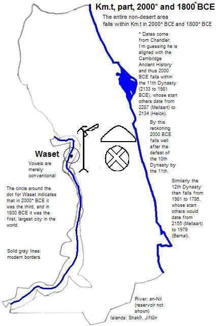
| Wɜ.st | 2000 BCE | | Km.t (Kemet or Egypt) | |
| Wɜ.st | 1800 BCE | | Km.t (Kemet or Egypt) | |
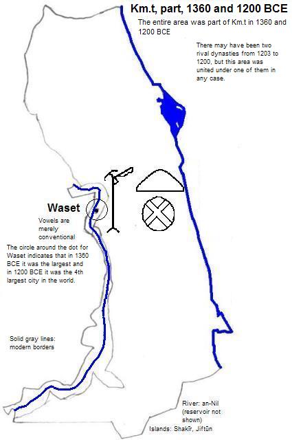
| Wɜ.st | 1360 BCE | 80,000| Km.t (Kemet or Egypt) | |
| Wɜ.st | 1200 BCE | | Km.t (Kemet or Egypt) | |
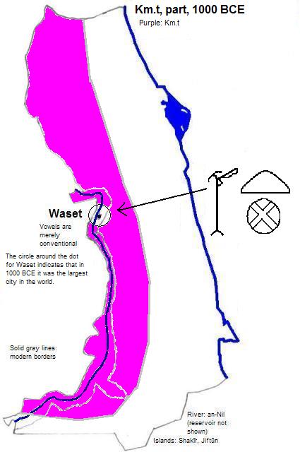
| Wɜ.st | 1000 BCE | | Km.t (Kemet or Egypt) | |
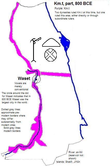
| Wɜ.st | 800 BCE | | Km.t (Kemet or Egypt) | |
Luxor Temple with dual statues


1. 2012 calculation in world-gazetteer.com, accessed 1/28/2012.
2. The vowels are conventional among Egyptologists but are not intended to represent the vowel sounds of the times. The initial 'A' was chosen merely because the character represented as ʒ was the first letter in the Egyptian alphabet.
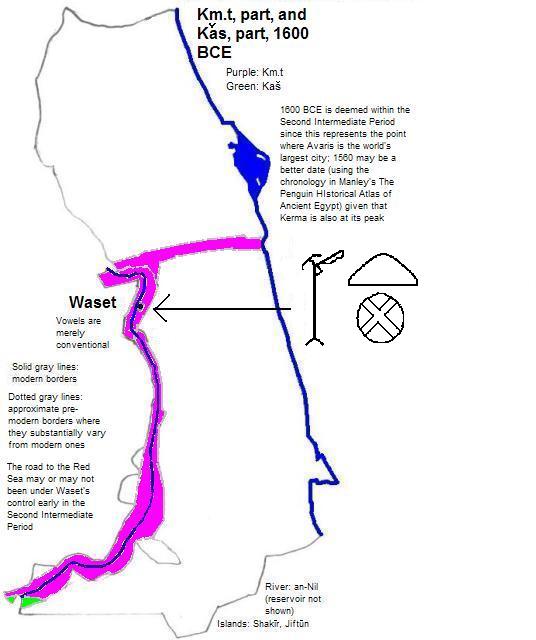
3. Spelling taken from Georges Roux, Ancient Iraq (3rd ed., Penguin Books, 1992). I interpreted this to be Aramaic Nun-Aleph for purposes of the glyph on the map.
4. I'm guessing that Tertius Chandler, Four Thousand Years of Urban Growth, 2nd ed. (The Edwin Mellen Press, 1987), is using the Cambridge Ancient History's dating, in which case 2000 BCE falls within the 11th Dynasty (2133 to 1981 BCE), whose start others date from 2287 (Mellaart) to 2134 (Helck). See Chronological Chart I in Martin Bernal, Black Athena, Volume II (Rutgers University Press, 1991). By this reckoning 2000 BCE falls well after the defeat of the 10th Dynasty by the 11th. Similarly 1800 BCE falls within the 12th Dynasty (1991 to 1786 BCE), whose start others date from 2155 (Mellaart) to 1979 (Bernal).
5. In 2000 BCE, Wɜ.st (Thebes) was smaller than ỉnbw-hḏ (Memphis), which had an estimated population of 60,000, and was bigger than Lagash, which was bigger than Susa, which had an estimated population of 25,000. In 1800 BCE, Wɜ.st was bigger than Mari, which was bigger than ỉnbw-hḏ, which was bigger than ỉwnw (Heliopolis), which was bigger than Susa, which still had an estimated population of 25,000. In 1800, 1360, 1000 and 800 BCE, Wɜ.st was the largest city in the world; in 2000 BCE, it was third, and in 1200 BCE, fourth.
6. Chandler, ibid, "Tables of World's Largest Cities: 1360 B.C."
7. In 1200 BCE, Wɜ.st (Thebes) was smaller than Dar-Kurilgalzu, which had an estimated population of 40,000; it was bigger than Ninua (Nineveh), which in turn was bigger than Susa, which had an estimated population of 30,000. Chandler, ibid, "Tables of World's Largest Cities: 1200 B.C."
8. There may have been two rival dynasties from 1203 to 1200 BCE, but in any case this area was united under one them.
9. In 1000 and 800 BCE, Wɜ.st was larger than Sian, which was larger than Loyang, which had an estimated population of 50,000--Chandler, ibid., "Tables of World's Largest Cities"