| To Duval Family Home Page | Asia |
| To Chris Home Page | भारत (Bhārat or India) |
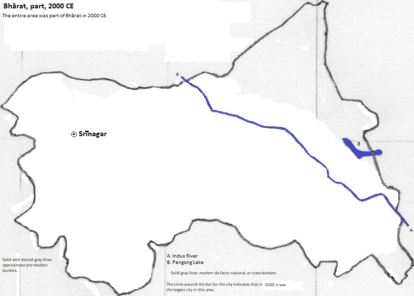
| To Earth (Geography Home Page) | Jammu and Kashmir |
Srīnagar
| Year | name | Political Entity | Population |
| 200 BCE | Śrīnagarī | Jambudvīpa (Mauryan Empire) | |
| 100 CE | Kushano (Kushana or Kuṣāṇa Empire) | ||
| 361 CE | Gupta Empire | ||
| 500 CE | Gupta Empire | ||
| 622 CE | Pravapura | Kingdom of Harsha (or Harṣa) | 45,000 |
| 1500 CE | Srīnagar | state of Shah Mīrs | 40,000 |
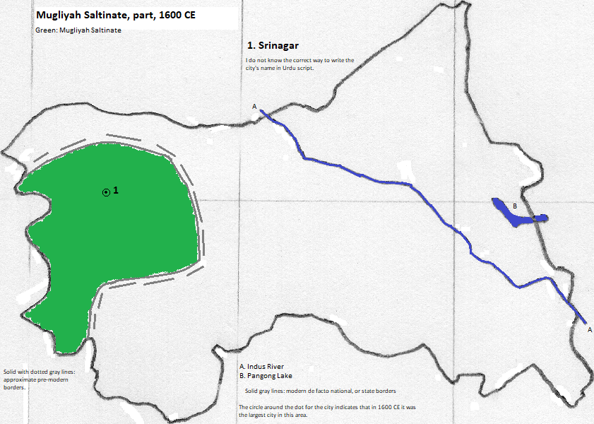
| 1600 CE | Srīnagar | Muglīyah Saltinate (Mughal Empire) | |
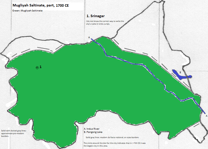
| 1700 CE | Srīnagar | Muglīyah Saltinate (Mughal Empire) | 125,000 |
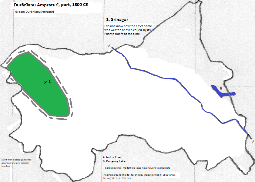
| 1800 CE | Srīnagar | Durānīanu Ampraturī | 52,000 |
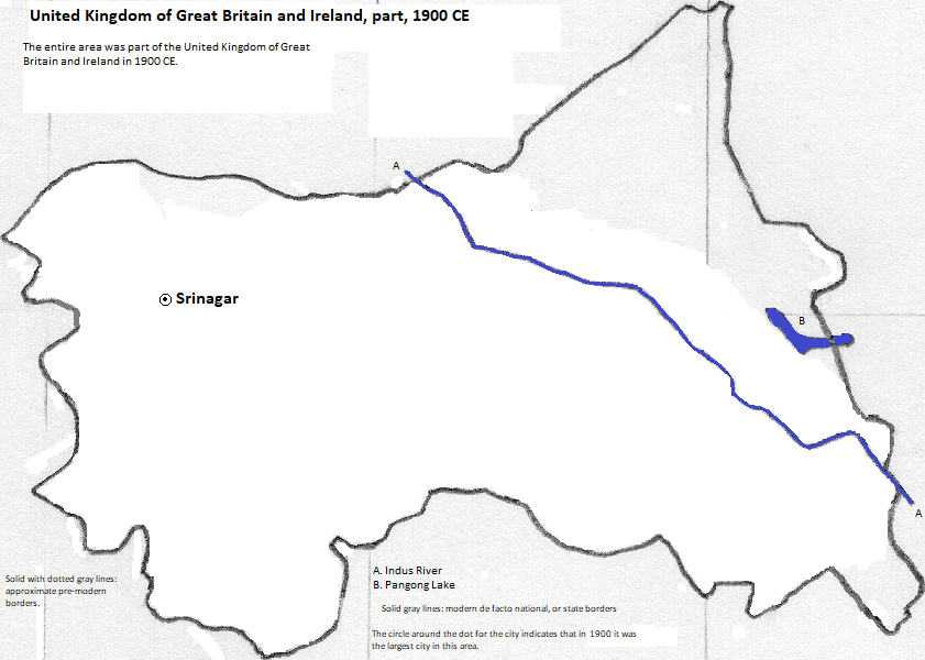
| 1900 CE | Srinagar | United Kingdom of Great Britain and Ireland (British Empire) | 122,000 |
| 2001 CE | Srinagar | Bhārat (India) | 988,000 (metro) |
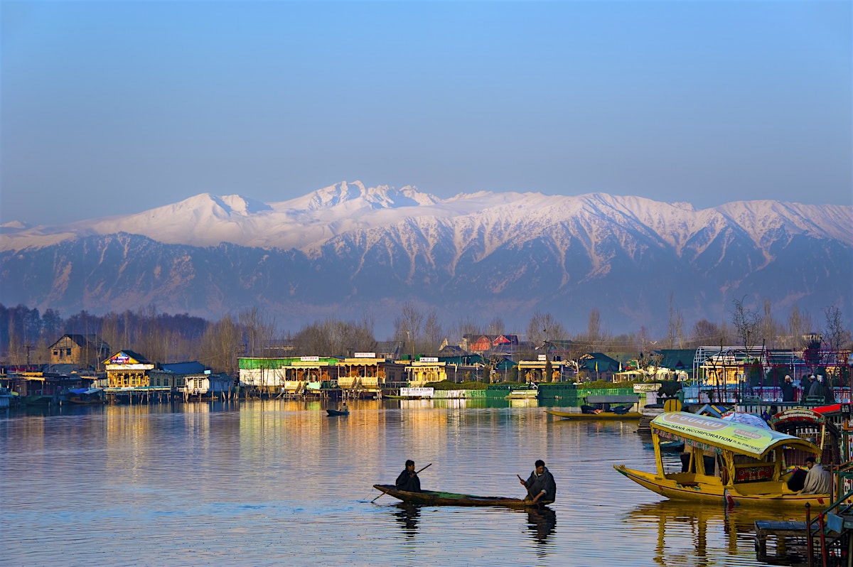
houseboats on Dal Lake, Srinagar, Jammu and Kashmīr, Bhārat, with mountains in the background
1. I do not know how to write the city's name in Urdu script, the state's official language. Signage for it is usually in English and Kashmiri.
2. I do not know how to write either Jammu or Kashmīr in Urdu script, the state's official language.
3. India in English.
4. 2011 and 2001 figures from http://www.citypopulation.de/php/india-jammukashmir.php, accessed December 25, 2018.
5. The Jhelum flows into the Indus, which flows into the Arabian Sea.
6. The original name was probably written in Brahmi script but I do not know how to write it that way.
7. The name is now Pandrethan. See https://en.wikipedia.org/wiki/Srinagar, accessed January 9, 2019, citing Vincent A. Smith, "The Early History of India" (Atlantic Publishers & Dist., 1999), p. 162.
8. https://www.holidify.com/state/jammu-and-kashmir/top-destinations-places-to-visit.html, accessed December 25, 2018. I selected the first ten.
9. https://en.wikipedia.org/wiki/List_of_the_busiest_airports_in_India, accessed December 25, 2018. I selected the two serving the state that had over a million passengers in 2017-2018.
10. It was 'probably' within the empire then according to Joseph E. Schwartzberg, ed., A Historical Atlas of South Asia (The University of Chicago Press, 1978), text for plate III.B.4 on pg. 170.
11. Tertius Chandler, Four Thousand Years of Urban Growth, 2nd ed. (The Edwin Mellen Press, 1987), "Tables of the World's Largest Cities." In 200 BCE it was larger than what is now called دمشق (Dimashq), which was larger than Madurai, which was larger than Amasi, which was larger than Vienne, which was larger than OlΌλβία Ποντική (Ólbía Pontiké), which had a population of 30 thousand. In 100 CE it was larger than, or equal to, Teotichuacán, which had a population of 45 thousand. It was smaller than, or equal to, Aror, which was smaller than Ganzhou, which was smaller than, or equal to, Balkh, which was smaller than Kolhapur, which was smaller than, or equal to, Vārānasi, which was smaller than ỉnbw-hḏ (Inebu-Hedju), which was smaller than, or equal to, Leptis, which was smaller than Madurai, which had a population of 50, thousand. In 361 CE it was larger than, or equal to, Taxila, which was larger than Θεσσαλονίκη (Thessaloníkē), which had a population of 42 thousand. It was smaller than, or equal to, Dvin, which was smaller than Vienne, which had a population of 45 thousand. In 500 CE it was larger than Starkr (Istarkr), which was larger than Ye, which was larger than, or equal to, Balkh, which was larger than Vārānasi. It was smaller than Tatung, which was smaller than, or equal to, Coptos, which was smaller than, or equal to, Bakhalal (Bacalar), which was smaller than Tikal, which was smaller than, or equal to Indrapura, which was smaller than Ungjin, which was smaller than, or equal to, Kavery, which was smaller than Kyongju, which was smaller than Merv, which was smaller than Yangzhou, which was smaller than what is now called دمشق (Dimashq), which had a population of 60 thousand. In 200 BCE, 100 CE, 361, 500, 622, 1700, 1800 and 1900 it was the largest city in what is now Jammu and Kashmir.
12. The name, and the spelling of the name, which would have been in Bactrian (also known as Kushan), is unknown to me. Schwartzberg, op. cit., labels it Śrīnagarī on Plate II.C.2.
13. Kashmiri was conquered by Vima Kadphises of the empire according to Schwartzberg, ibid., pg. 175.
14. It is still labeled Śrīnagarī on Plate II.d.1, Schwartzberg, ibid.. I do not know its correct Gupta name in Sanskrit or a Prakit, nor how to represent it in Brahmi script or a derivative.
15. The empire did not have a standard contemporaneous name. Schwartzberg, ibid., Plate III.D.1.b. shows imperial tributary limits under Samundragupta. Candragupta II "appointed a governor for Kāśmīra, indicating thereby its incorporation into the empire during either his father's regin or his own (pg. 179).
16. There was no change in status until 518 according to Schwartzberg, ibid., Plate II.D.1.b.
17. I do not know how the name was written in Brahmi script or its derivative.
18. The name of the state is unclear, and may be nothing beyond a designation of dynastic or regal possessions. The vale was part of this state: "his [the Harsha ruler's] successful invasions of Kashmir and Sind," Schwartzberg, op. cit., pg. 181.
19. The name is on Schwartzberg, op. cit., Plate V.4.a. I do not know how it was written at the time by its shah.
20. I do not know what the shah called his state.
21. Chandler, op. cit., Cities of Asia. In 1600 it was larger than Jodhpur, which had a population of 45,000. It was smaller than Amber, which had a population of 50,000. In 1500 and 1600 it was the largest city in what is now Jammu and Kashmir.
22. The name is on Schwartzberg, op. cit., Plate VI.A.1.a (covering 1600) and, for VI.A.3.a (covering 1700).
23. The city is within the empire according to text on Plate VI.A.1.a (covering 1600), and Plate VI.1.3.c (covering 1700), ibid..
24. The name is on Schwartzberg, ibid., Plate VII.A.2, but I do not know if the Pashto rulers called it thus, nor how it was written by them.
25. This Roman spelling is based on the transliteration table from https://en.wikipedia.org/wiki/Pashto_alphabet, using the pre-translitrated name from https://en.wikipedia.org/wiki/Durrani_Empire, both accessed January 22, 2019.
26. Also called the Afghan Empire.
27. That the city is within the empire is based on the borders shown in Schwartzberg, op. cit., text on Plates VIIA.1.a and VIIA.2.a, and noting that the Kashmīr Valley was not conquered by the Sikhs, so the valley was a disconnected piece of the empire (see also Plate VII.A.2.b).