| To Duval Family Home Page | Europe | |
| To Chris Home Page | Deutschland, België, Nederland, Luxembourg and Danmark | |
| To Earth (Geography Home Page) |
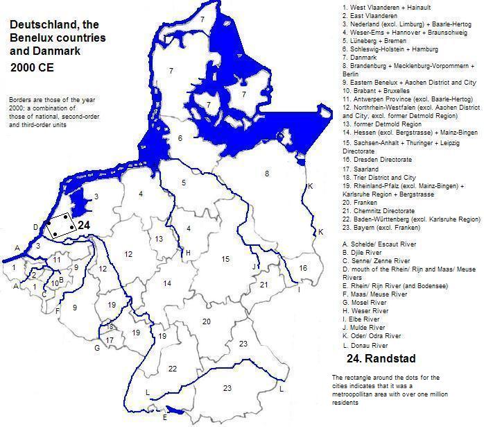
The Randstad metropolitan area of 6.6 million people centers on four cities in the Netherlands
The two World Heritage Sites in the area are: the Defence Line of Amsterdam, an integration of waterworks, dykes and a chain of forts; and Utrecht's Rietveld Schröderhuis (Rietveld Schröder House), built by the architect Rietveld, deemed exemplary of both the De Stijl group of artists and architects and of architecture's Modern Movement.
René Descartes worked in Leiden (northeast of 's-Gavenhage) and published his Geometry, an appendix to his philosophical work, in 1637.
Haarlem, west of Amsterdam, is the export center for tulips, and is a popular tourist destination.
| City | Year | Population | Political entity |
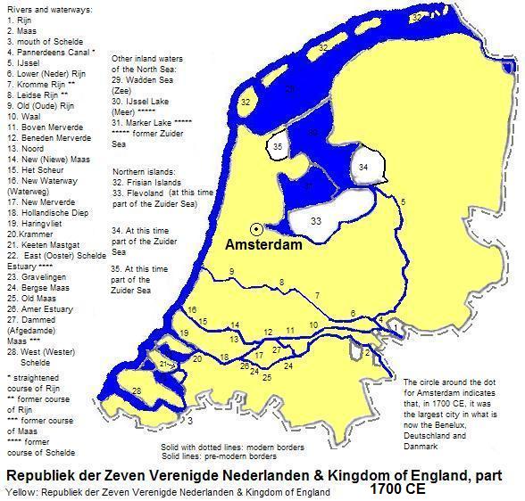
| Amsterdam | 1700 | 210,000 | Republiek der Zeven Verenigde Nederlanden (Republic of the Seven United Lowlands, or the United Provinces) |
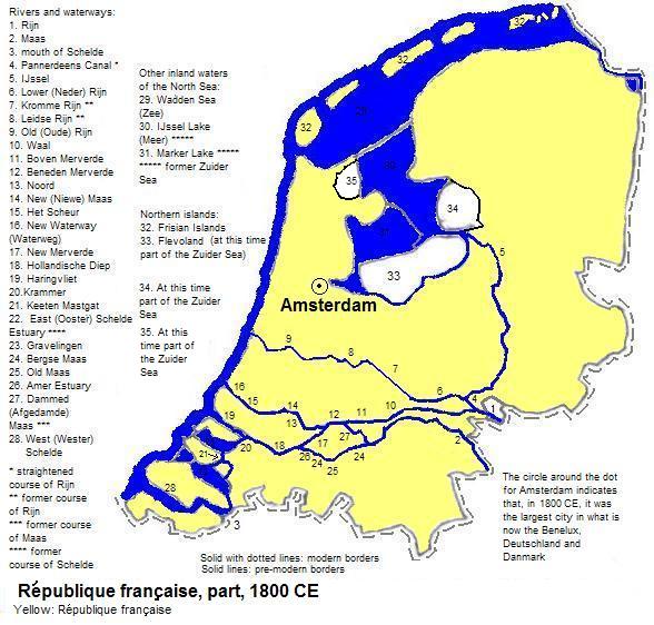
| Amsterdam | 1800 | 195,000 | République française (locally the nominally independent Bataafse Republiek) |
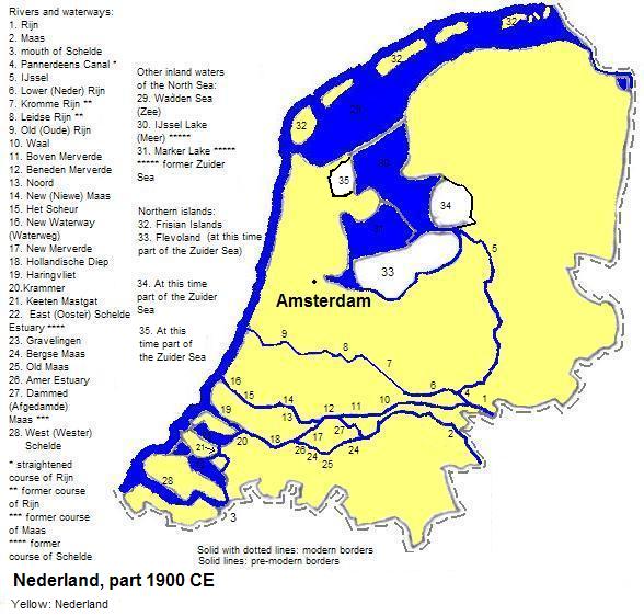
| Amsterdam | 1900 | 510,000 | Nederland (the Netherlands) |


1. Nederland in Dutch.
2. The Hague in English. Den Haag is an alternate name.
3. Spelled Rijn locally.
4. Meuse in French.
5. World Heritage Sites (Unesco and Firefly Books, 2010).
6. Estimates in Tables of the World's Largest Cities in Tertius Chandler, Four Thousand Years of Urban Growth, 2nd ed. (The Edwin Mellen Press, 1987). In 1700 and 1800 Amsterdam was the largest city in what is now Benelux, Deutschland (Germany) and Danmark (Denmark).
7. In 1700, the head of the Republiek der Zeven Verenigde Nederlanden was also the king of England.