Puebla
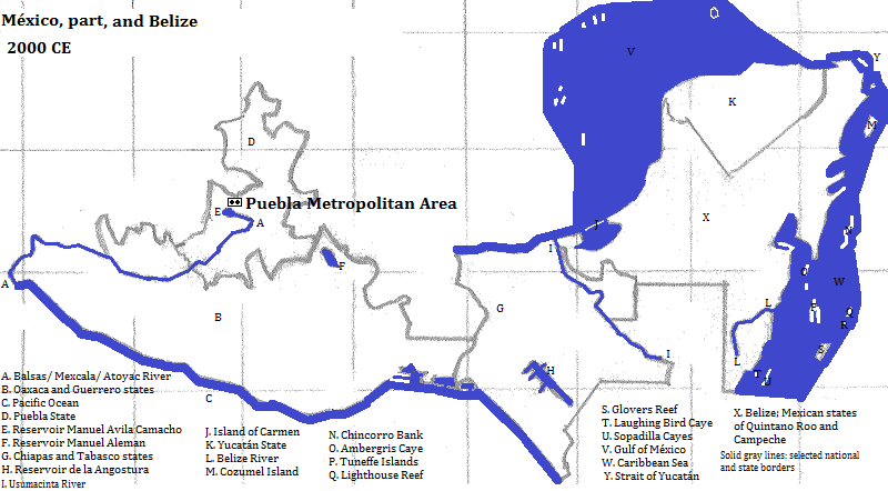
The metropolitan area of Puebla is located in a mountain valley, at the southern end of the Puebla-Tlaxcala Plateau, in Puebla state, México. In 2012 it had a population of 3.148 million.1 The city of Heróica Puebla de Zaragoza (Puebla for short) had a population of 1.34 million (2010).2 In post-classical pre-Columbian times, Cholula3 (called Cholōllān when the Chololtecs took over) was the important place; Puebla proper was founded in 1531, gaining its longer name in the middle of the 19th century.
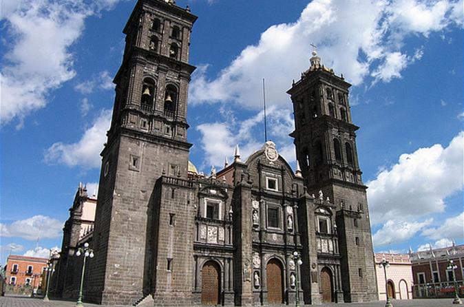
The historical center of Puebla is honored by UNESCO as a World Heritage Site. Attention is drawn to: the Cathedral of Santa Domingo (1690, also called the Catedral Metoplitana--that is, the Metropolitan Cathedral, 240 feet);4 the Jesuit Church; the old Archbishop's palace; houses with tiled (azulejos) roofs; and 19th century 'transformations.'5
The most famous colonial-era building in Cholula, a city of 118 thousand,6 is the Templo de San Gabriel. The tallest building is Torre (tower) JV III (396 feet, 2008).7
| Year | Population | Political entity |
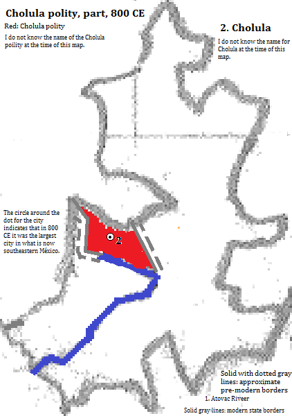
| 800 CE | 8| Cholula city entity9 | |
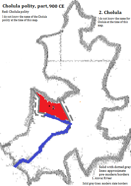
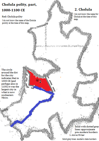
| 1000 CE | 8| Cholula city entity9 | |
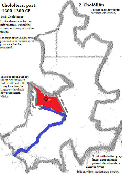
| 1200 CE | 8| Chololtecs10 | |
| 1300 CE | 8| Chololtecs10 | |
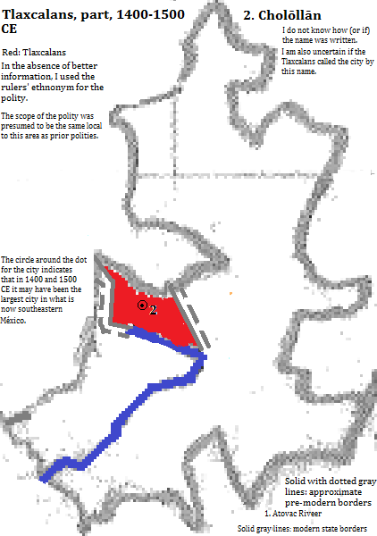
| 1400 CE | 8| Tlaxcalans10 | |
| 1500 CE | 36,0008| Tlaxcalans10 | |
| 1600 CE | 25,0008| Monarchia hispanica (Spanish Empire) | |
| 1700 CE | 63,0008| Monarchia hispanica (Spanish Empire) | |
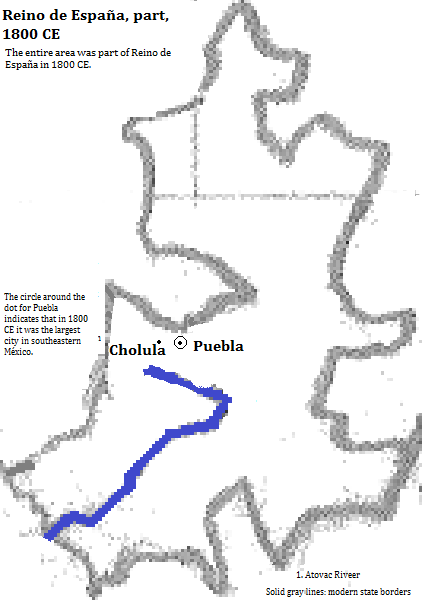
| 1800 CE | 65,0008| Reino de España (Spanish Empire) | |
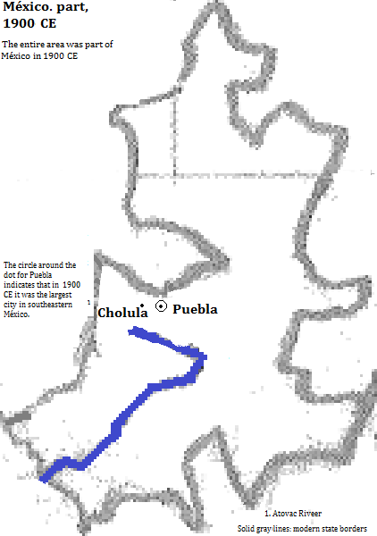
| 1900 CE | 98,0008| México | |
| 2012 CE | 3,148,0001| México | |
External references
Cathedral of Santo Domingo (Holy Sunday, also called the Catedral Metropolitana--that is, the Metropolitan Cathedral, Heróica Puebla de Zaragoza (Puebla for short), Puebla state, México
Historical maps

Footnotes
1. world-gazetteer.com, accessed February 6, 2013.
2. https://en.wikipedia.org/wiki/List_of_cities_in_Mexico, accessed April 28, 2016.
3. Cholula is its name in Nahuatl. I do not know the Oto-mangue name.
4. The date for completion, the height and the other name come from emporis.com, accessed April 28, 2016. According to that site the cathedral is the tallest building as of the spring of 2016.
5. UNESCO, World Heritage Sites (Firefly Books, 2010).
6. 2005 figure from the side bar of https://en.wikipedia.org/wiki/Cholula,_Puebla, accessed April 28, 2016. Cholula is divided into two parts.
7. Emporis.com, accessed April 28, 2016.
8. The population in 800 CE was smaller than El Tajín, which had an estimated population of 40 thousand. In 1000 it was smaller than Khajuraho, which had a population of 40,000, but was bigger than Chichén Itzá, which was bigger than Uxmal, which was bigger than Xochicala, all of whose sizes are not enumerated. In 1200 Cholōllān was smaller than Azcapotzalco, which was smaller than Texcoco, which was smaller than Tenayuca, which had a population of 50,000. In 1300, it was smaller than Texcoco, which had a population of 50,000, and larger than Azcapotzalco, whose size was not enumerated. In 1400 it was smaller than Texcoco, which had a population of 60,000. Estimates for Cholula/ Cholōllān in 800, 1000, 1200, 1300 1400 and 1500 CE and for Puebla in 1600 CE are from Continental Tables and Maps: The Americas, in Tertius Chandler, Four Thousand Years of Urban Growth, 2nd ed. (The Edwin Mellen Press, 1987). Figures for Puebla for 1700, 1800 and 1900 from his Tables of the World's Largest Cities. Cholula was the largest city in southeast México in 800 and 1000, perhaps also in 1200, 1300, 1400 and 1500. Puebla was the largest city in 1600, 1700, 1800, 1900 and today.
9. I do not know the name of the Oto-mangue political entity.
10. The name of the polity is presumed, in the absence of better information, to be the same as the rulers' ethnonym.