.jpg)
| To Duval Family Home Page | Europe |
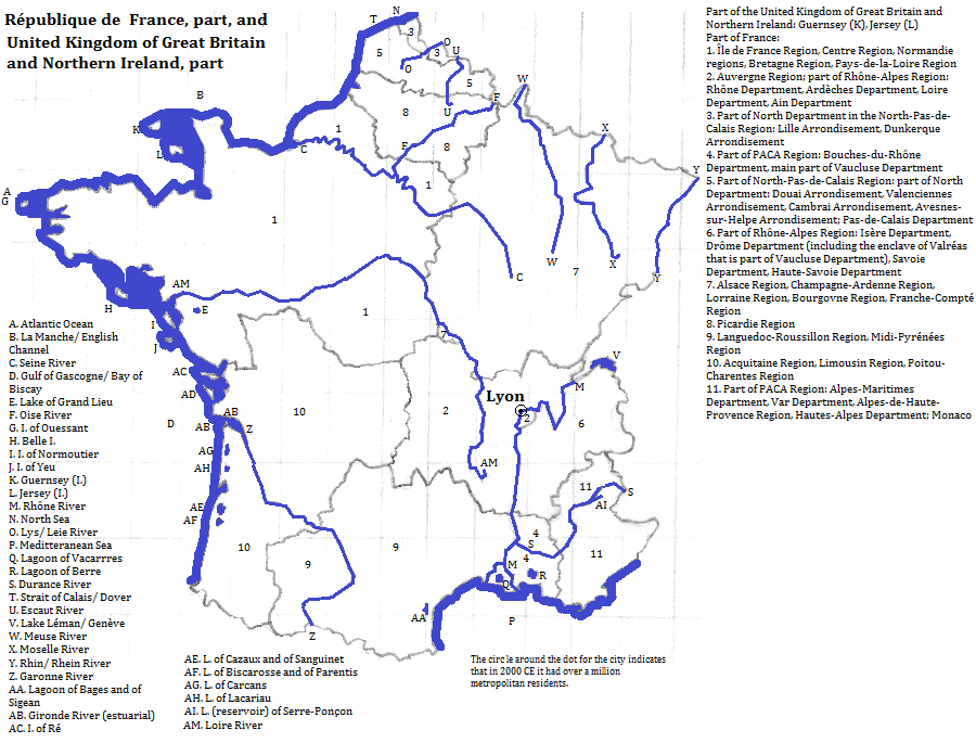
| To Chris Home Page | France |
| To Earth (Geography Home Page) | France and its possessions |
Lyon in the Rhône Department
The tallest building is the 42 story Tour Part-Dieu (1977). Another famous building is the Basilique Notre-Dame de Fourvières.
The mathematician and architect, Girard Desargues, was born in Lyon.
| Name | Year | Population | Political entity |
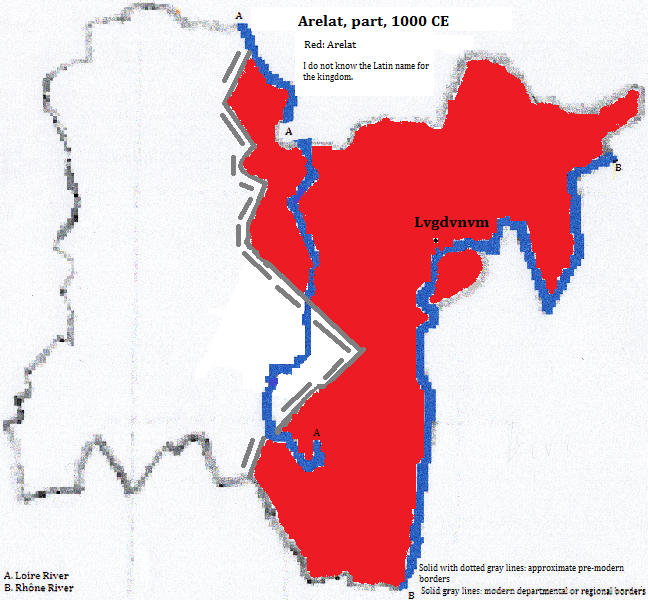
| Lvgdvnvm | 100 CE | 50,000 | Senatvs Popvlvsqve Romanvs (Roman Empire) |
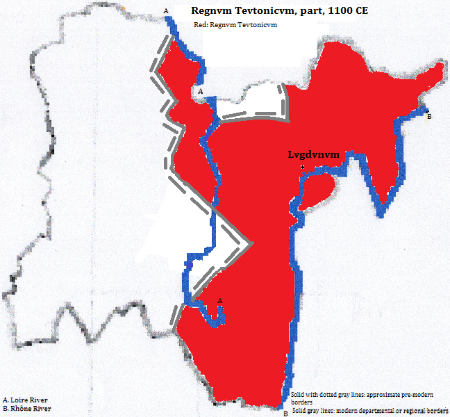
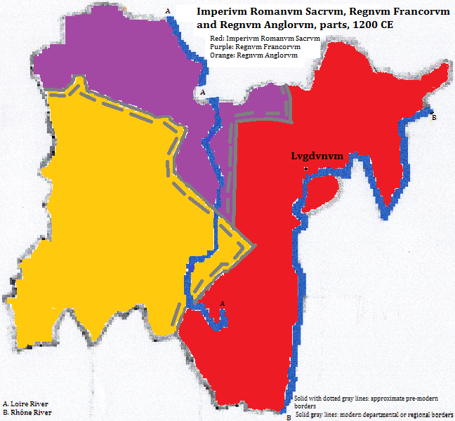
| Lvgdvnvm | 1200 CE | 22,000 | Imperivm Romanvm Sacrvm (the Holy Roman Empire) |
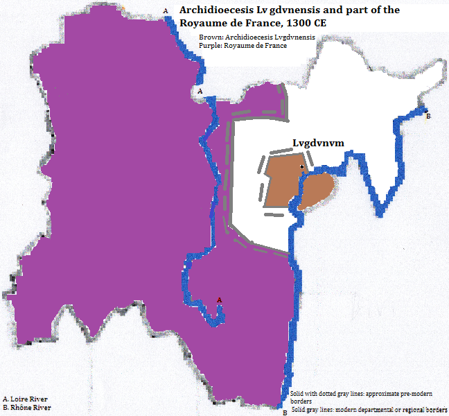
| Lvgdvnvm | 1300 CE | 35,000 | Archidioecesis Lvgdvnensis (Archbishopric of Lyon) |
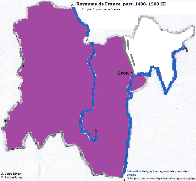
| Lyon | 1400 CE | 35,000 | Royaume de France |
| Lyon | 1500 CE | 40,000 | Royaume de France |
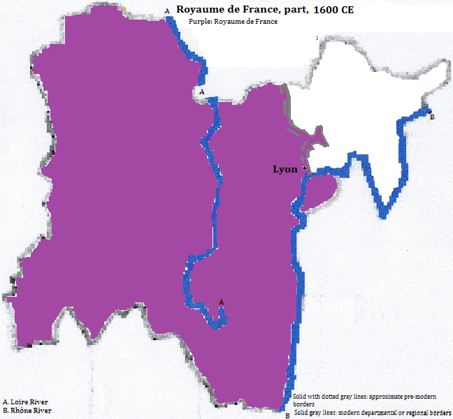
| Lyon | 1600 CE | 30,000 | Royaume de France |
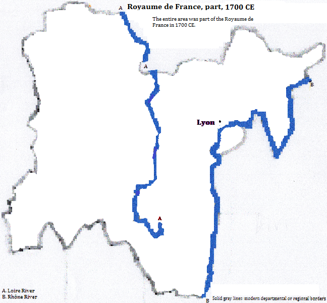
| Lyon | 1700 CE | 97,000 | Royaume de France |
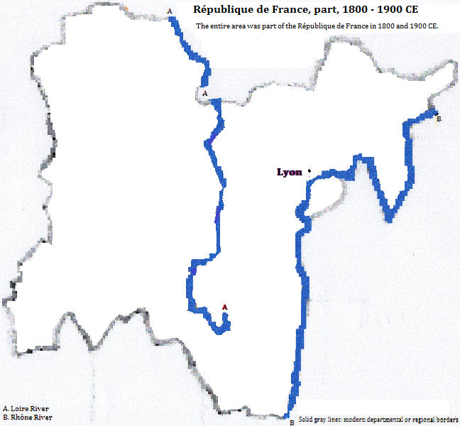
| Lyon | 1800 CE | 110,000 | République de France |
| Lyon | 1900 CE | 508,000 | République de France |
| Lyon | 2012 CE | 1,863,000 | République de France |
Basilique Notre-Dame de Fourvières, Lyon, Rhône Department, Rhône-Alpes Region, France

1. Rhône-Alpes Region.
2. World-gazetteer.com, accessed 2/6/2013.
3. http://simple.wikipedia.org/wiki/List_of_cities_in_France, accessed 2/5/2015.
4. Information about the ampitheatre, the council and the theatre is from UNESCO, World Heritage Sites (Firefly Books, 2010). Hill names are French.
5. Emporis.com, accessed 3/3/2015.
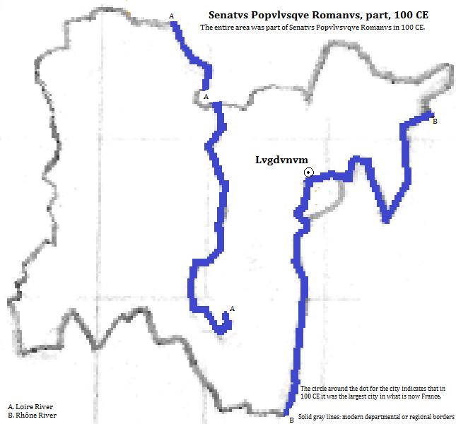
6. Tables of the World's Largest Cities, in Tertius Chandler, Four Thousand Years of Urban Growth, 2nd ed. (The Edwin Mellen Press, 1987). In 100 CE it was the largest city in what is now France.
7. 'Cities of Europe, [Germany or France], [1200 or 1300 or 1400 or 1500 or 1600],' in Ibid..