| To Duval Family Home Page | Europe | |
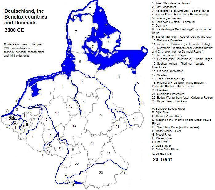
| To Chris Home Page | Deutschland, België, Nederland, Luxembourg and Danmark | |
| To Earth (Geography Home Page) |
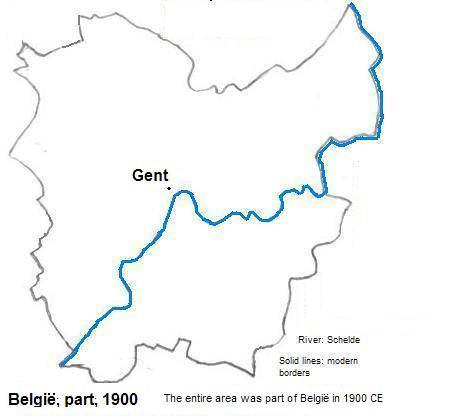
Gent (or Gand in French, Gante in Spanish, Ghent in English) is a city of about a quarter million residents
| City | Year | Population | Political entity |
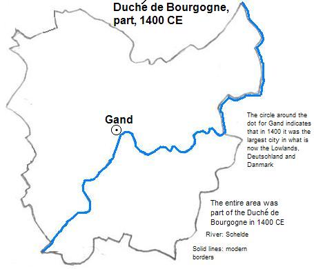
| Gand | 1400 | 70,000 | Duché de Bourgogne (Interim Kingdom of Burgundy) |
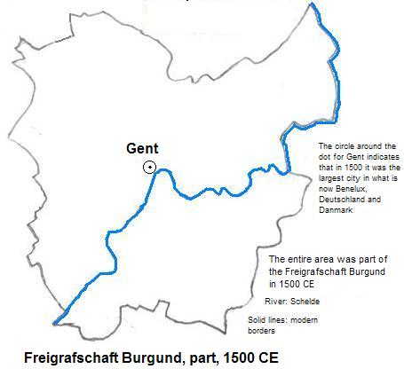
| Gent | 1500 | 80,000 | Freigrafschaft Burgund (Hapsburg Burgundy, nominally Imperium Romanum Sacrum or Holy Roman Empire) |
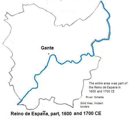
| Gante | 1600 | 31,000 | Reino de España (Spain, nominally the independent Países Bajos españoles, and also nominally part of the Imperium Romanum Sacrum or Holy Roman Empire) |
| Gante | 1700 | 49,000 | Reino de España (Spain, though also nominally part of the Imperium Romanum Sacrum or Holy Roman Empire) |
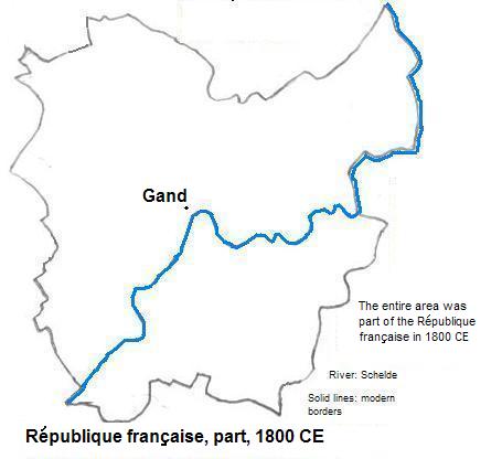
| Gand | 1800 | 51,000 | République française (French Republic) |
| Gent | 1900 | 198,000 | België (Belgique or Belgium) |
1. World-gazetteer.com, accessed, 1/8/2011.
2. The heights and the size of the dragon sculpture are from emporis.com, accessed 1/8/2011. The MG Tower under construction will be higher than 100 meters.
3. Shared with other locations.
4. Estimates in Tables of the World's Largest Cities in Tertius Chandler, Four Thousand Years of Urban Growth, 2nd ed. (The Edwin Mellen Press, 1987). In 1400 and 1500 Gand or Gent (Ghent) was the largest city in what is now Deutschland, België, Nederland, Luxembourg and Danmark.
5. Nominall