| To Duval Family Home Page | Africa |
| To Chris Home Page | |
| To Earth (Geography Home Page) |
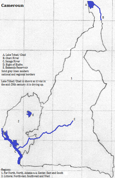
Cameroon divides into three pieces. The southernmost consists of a small coastal plain and a forested interior plateau. In a broken line from the coast near Nigeria northeastward are mountains and massif, most spectacularly at the volcano with the nation's name, which tops 4000 meters. North of the massif the land falls toward Lake Tchad,
There is one UNESCO World Heritage Site: the Dja Faunal Reserve. Tourists visit Mile Six Beach, Mount Cameroun and Korup and Waza national parks.

More than one in five Cameroonians speak Beti
More than half of the country is Christian: one in three or so Roman Catholic, and the rest Protestant. Moslems are more than one in five, and the remaining 26 percent follow local religions.
Douala, and the capital, Yaounde are the only two cities with over a million people. Other cities of note include: Bamenda, Kribi and Limbe.
A major suburb of N'Djamena, Chad's capital, is located in the narrow neck of far northern Cameroon.
Kribi is a coastal resort, and tourists like Limbe for its botanical garden and Bamenda for its ring road.
The Bantoid language group
The relative strength of the various language shifted after Europeans arrived. Bulu was favored by American Presbyterian Christian missionaries, Fang by Catholics and Ewondo
Two former lingua francas belong to the Adamawa-Ubangi language group. One was Mbum, until it was gradually replaced by Fulfulde in recent centuries; and another, Gbaya, primarily on both sides of what is now the border with the Central African Republic, but also in places further north where Gbaya-speaking slaves were transported.
European languages and religions arrived starting in the 19th century. Français attained its predominance after the defeat of Deutschland

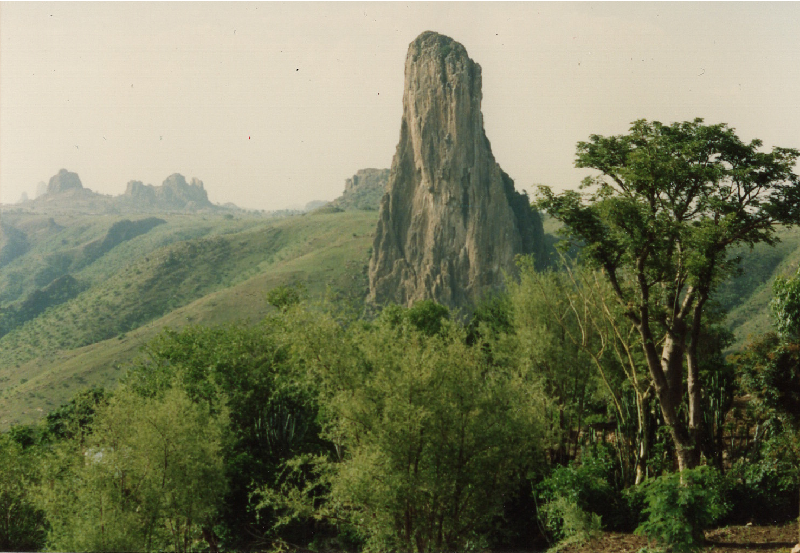
Hills of northern Cameroun (Cameroon)
north
east, from the north
east, from the south
southeast
south, from the southwest
southwest
west
1. Cameroon in English, which is also an official language.
2. Chad in English. It was Africa's third largest lake before it started shrinking.
3. Benue in English.
4. African in English.
5. Brazzaville Congo.
6. Here I mean the collection of Fang, Ewonde, Bulu, Eton and Mengisa. These are sometimes considered separate languages, and Beti is sometimes merely a name for a dialect.
7. The language of the Fulani. First language speakers are mostly near the Adamaoua (Adamawa) Mountains.
8. French in English.
9. It has a growing number of first language speakers, especially in coastal cities; thus it is becoming a creole. There are about two million second language speakers.
10. Part of the bigger Benue-Congo group.
11. Yaounde in French; Jaunde in German.
12. A German (Deutsch) pidgin once existed as well.
13. Germany in English.