| To Duval Family Home Page | North America |
| To Chris Home Page | United States of America |
| To Earth (Geography Home Page) | Anglo-North America |
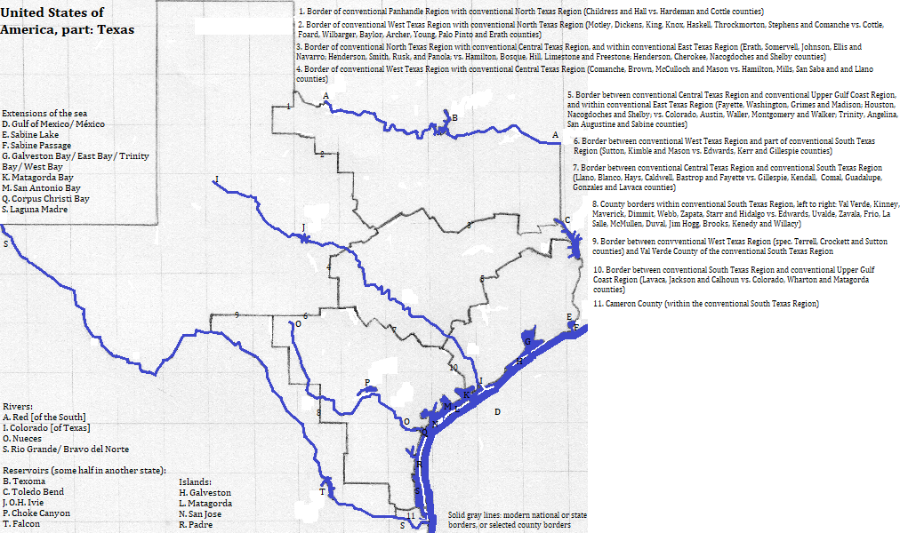
This area is divided into three of the continent's main geophysical divisions: the Basin and Range Province representing the Intermontane Plateaus (part of the Western Cordillera); the Interior Plains; and the West Gulf Coastal Plain representing the Atlantic Coastal Plain. Big Bend National Park, a tourist attraction,
The Basin and Range Province is a northwest to southeast stripe across southwestern Texas. The Interior Plains are represented by the Great Plains--in western and central Texas--and by the Central Lowland--in north central Texas. The Coastal Plain is in eastern and southern Texas.
The Arkansas River enters from Oklahoma and flows through the Coastal Plain.
The Rio Grande forms Texas's southern border, starting in the Basin and Range Province, crossing the Great Plains at its great bend, and ending in the Gulf of Mexico within the Coastal Plain.
This state is in the part of North America in which English-speakers and Christians are the majority.
See the list of cities of Texas.
There are important oil
The Apache languages, part of the Athapascan group, were spoken in western Texas.
Also in western Texas Comanche, an Uzo-Aztecan language, was spoken. This group spread the religious use of peyote northward into Oklahoma, then "Indian Territory", where a variety of peoples adopted its sacred use. This gave rise to the Native American Church.
In the center of Texas was one isolate language group, the Tonkawa, and along the Texas-Lousiana border another, the Atakapa. These are sometimes grouped with many other languages including the Muskogean group to form a large assembly.
A Hokan language, Coahuiltec, was spoken on both sides of the lower Rio Grande.
A language isolate, the Karankawa was spoken on the Gulf coast farther southwest than Galveston Bay.
A Caddoan language, Wichita, was spoken near the Red River.
Smallpox and measles devastated indiginous populations in the late 18th century.
The Spanish invaded and took over the area. UNESCO honors the Spanish-era missions of San Antonio as a World Heritage Site. After Mexico became independent it invited to Texas English-speaking people who were willing to learn Spanish and convert to Catholicism. Some of these revolted against Mexico, partly due to the nation's opposition to slavery. Soon after the United States, favoring slavery, annexed the area. Texas remains heavily influenced by its Spanish heritage, and Mexican immigrants continue to arrive.
Bar bottles in an old safe, El Capitan Hotel, Van Horn, Texas, United States of America