
| To Duval Family Home Page | Asia |
| To Chris Home Page | महाराश्त्र (Mahārāshtra) |
| To Earth (Geography Home Page) | भारत (Bhārat or India) |
पैठण (Paiṭhaṇ) is a city of 35 thousand (2001)
| Year | Population | Political entity |
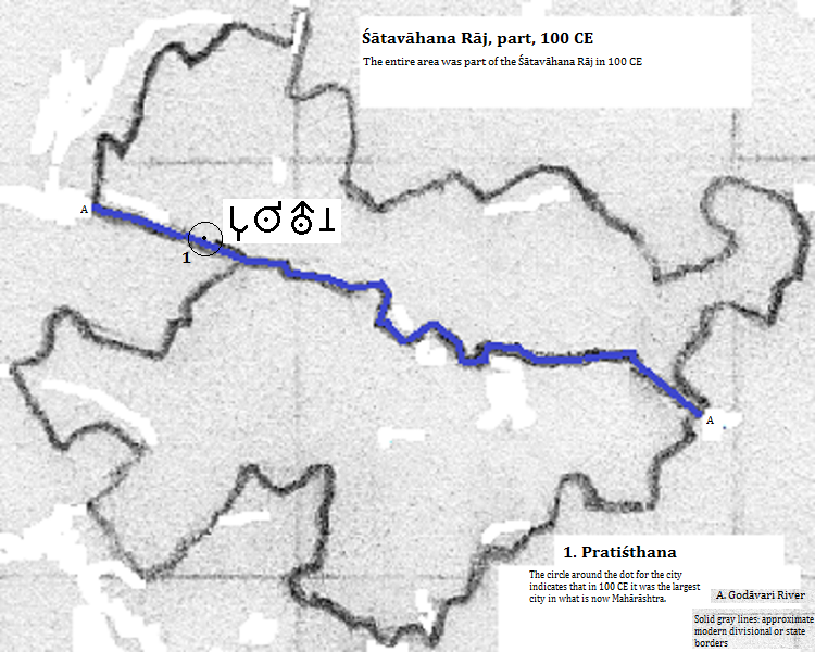
| 200 BCE | 60,000 | Ṣātavāhana Rāj (Ṣātavāhana empire) |
| 100 CE | Ṣātavāhana Rāj (Ṣātavāhana empire) | |
| 2001 CE | 35,000 | भारत (Bhārat or India) |
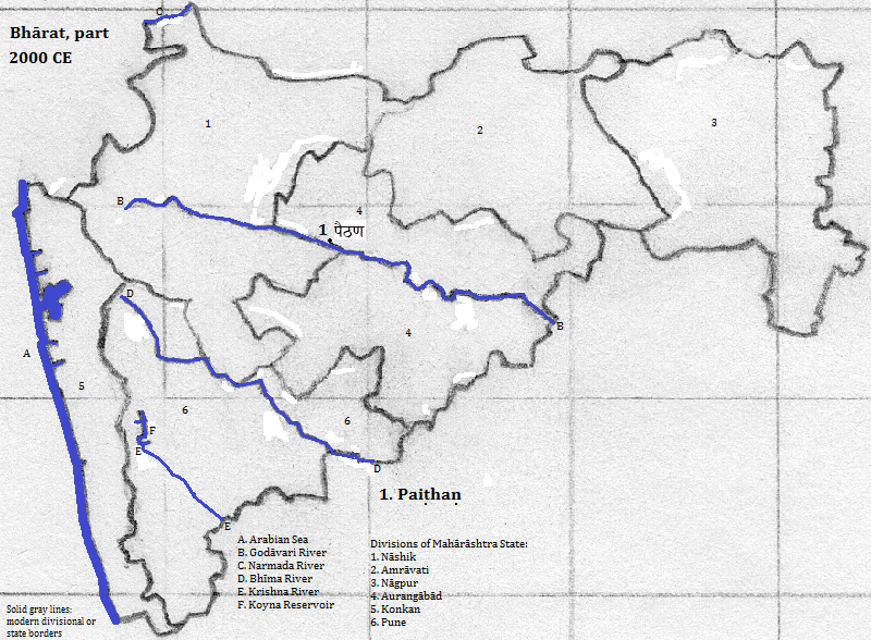
Jain tirth in Paiṭhaṇ, Aurangābād Division, Mahārāshtra, Bhārat (or India)
1. Side banner of http://en.wikipedia.org/wiki/Paithan, accessed 9/29/2014.
2. Ideally the final consonant cluster and vowel is rendered by a single ligature for the three akṣaras.
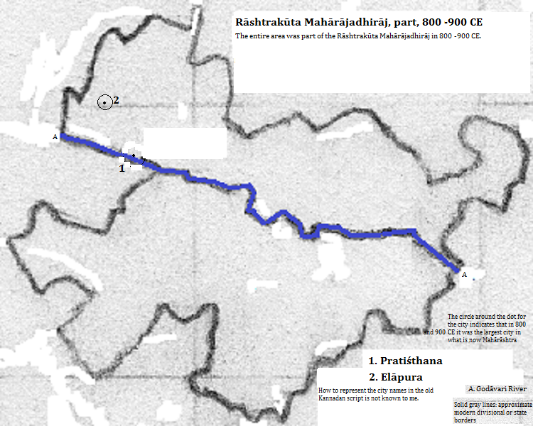
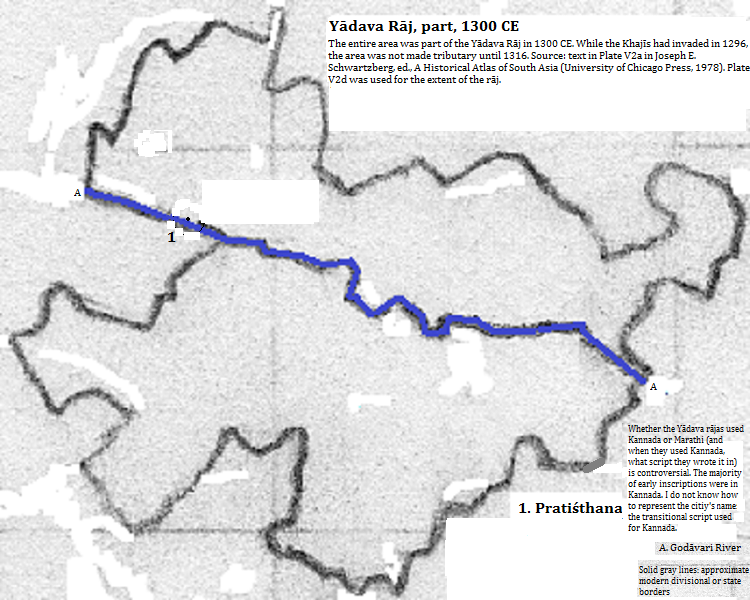
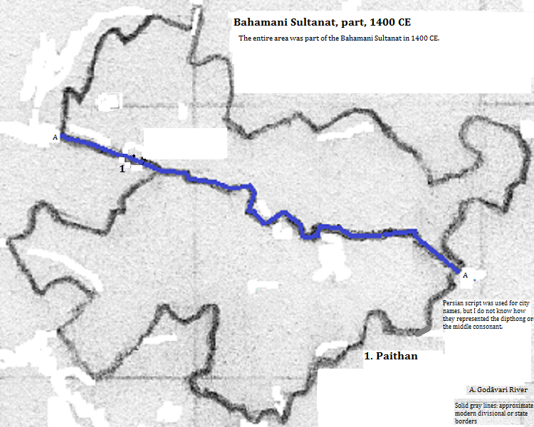
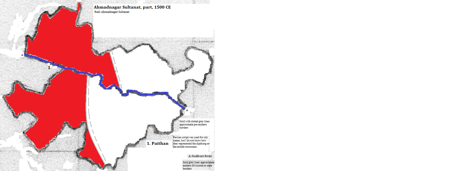
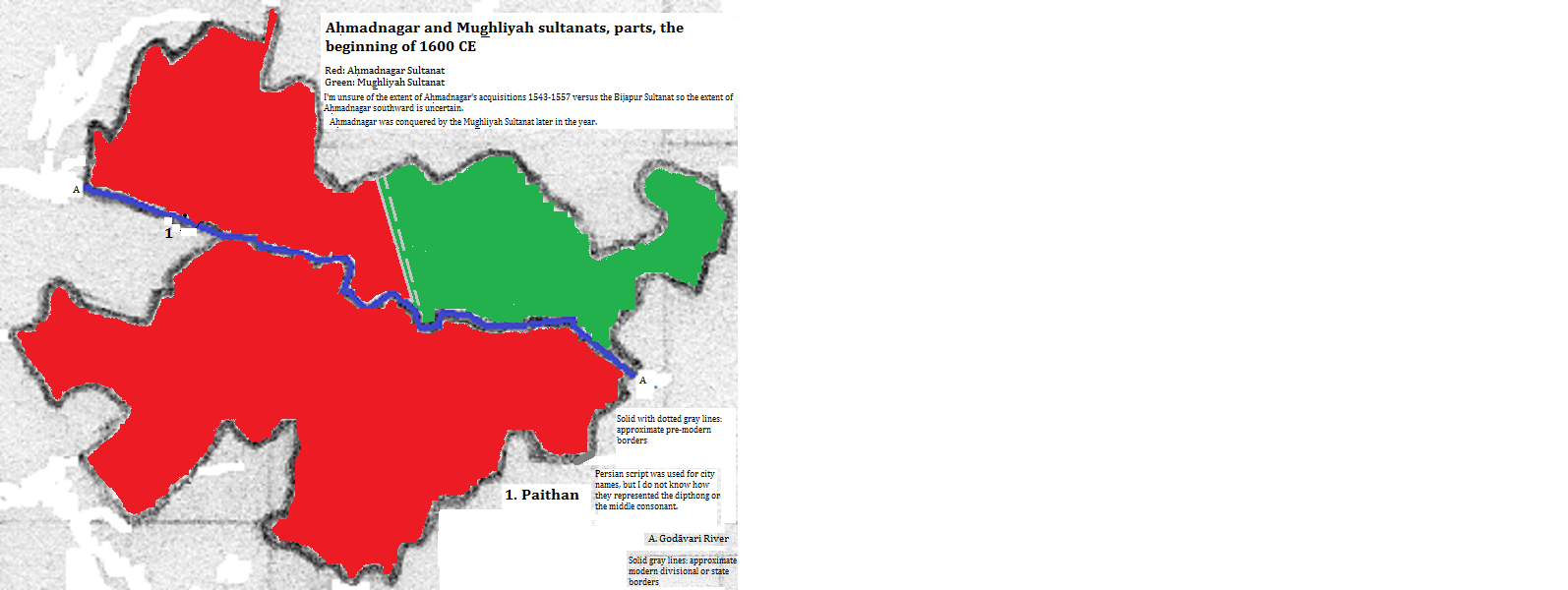
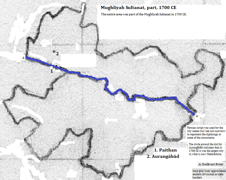
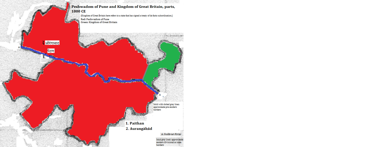
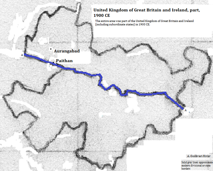
3. Plate III.c.1 map (c) and plate III.c.2 map (b) in Joseph E. Schwartzberg, ed., A Historical Atlas of South Asia (University of Chicago Press, 1978).
4. Estimate in Tables of the World's Largest Cities, in Tertius Chandler, Four Thousand Years of Urban Growth, 2nd ed. (The Edwin Mellen Press, 1987). In 200 BCE and 100 CE Pratiṣana was the largest city in what is now महाराश्त्र (Mahārāshtra). In 100 CE its population was smaller than Ecbatana, which was smaller than Smyrna, which had an estimated population of 90 thousand. It was larger than Changan, which was larger than Nanjing, which was larger than Athēnai (Athens), which had an estimated population of 75 thousand.