| To Duval Family Home Page | North America | Anglo-North America |
| To Chris Home Page | United States of America | Canada |
| To Earth (Geography Home Page) | France and its possessions |
Four of the continent's zones cross this area.
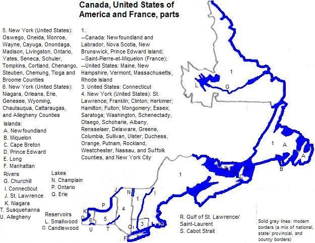
First are the Interior Plains, represented by the Eastern Lake Section of the Central Lowland. These line Lake Erie--very narrowly--and Lake Ontario--wider--and crosses the St. Lawrence River to exit this area. The two lakes are connected and are part of the St. Lawrence's headwaters.
Second are the Appalachian Highlands, represented by the Appalachian Plateaus--most of upstate New York; the Valley and Ridge Province--the Hudson River Valley and Lake Champlain; the Adirondack Province--most of northern New York; the New England Province--most of the six New England states plus a little bit of downstate New York and part of New Brunswick; the St. Lawrence Valley--northernmost New York; and part of the Piedmont Lowland Section of the Piedmont Province--a little bit of the valley by the lower course of the Hudson. The rest of the Maritime Provinces, including the island of Newfoundland, are also in the Appalachian Highlands.
Third is the Embayed Section of the Atlantic Coastal Plain. Within this area this is Staten Island, Long Island, the islands south of New England and Cape Cod.
Fourth is the Laurentian Upland or Canadian Shield; only Labrador is within this zone.
There are five large cities: see Cities of New York, New England and the Maritime Provinces
There are five World Heritage Sites in the area: the Statue of Liberty (New York City); Niagara Falls (Buffalo metropolitan area
Other regional attractions include the Statue of Liberty (New York, New York); Cabot Trail and the Cape Breton Highlands (rural Nova Scotia); the Bay of Fundy (New Brunswick and Nova Scotia); the National Baseball Hall of Fame (in a small town in New York); Portland, Maine; Plymouth Rock (in a small town in Massachusetts); Providence, Rhode Island; and the East Coast Trail (St. John's, Newfoundland island).
Before the arrival of Europeans, the eastern part of this area--excepting the province of Newfoundland--was inhabited by speakers of Algonguian languages like Penobscot, Abnaki, Massachuset, Naraganset, Wampanoag, Pennacook, Pequot, Mahican, Wappinger, Montauk, Abnaki, Penobscot, Passamaquoddy, Malecite and Micmac. A series of smallpox plagues in the 16th century and typhoid in the 18th century much reduced their numbers. There are still 8,000 Micmac speakers (plus others in Québec).
Beothuk, a language isolate, was spoken on the island of Newfoundland.
Inuktitut, the language of the Inuit, is and was spoken along the coast of Labrador.
Further west were the Iroquoian groups: Seneca, Cayuga, Onondaga, Oneida and Mohawk. Most members of these five civilized 'tribes' were killed by Euro-Americans in the Revolutionary War. Their former religion included the False Face Society and Midwinter Ceremony. A post contact development was the accomodationist Handsome Lake Longhouse religion.
The English and French arrived along the coast in the 17th century. (A brief Dutch colony gave way to the British.) After France was defeated by the United Kingdom, the French were forcibly removed by the British to Québec. The Maritime Provinces filled with English-speakers from further south after the United States successfully rebelled against British rule. Meanwhile the English speakers pushed westward, violently displacing the natives.
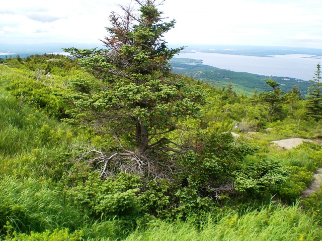
Cadillac Mountain, Adadia National Park, Maine
1. Saint Peter and Miquelon in English.
2. Extends into southwestern Canada.