| To Duval Family Home Page | North America | |
| To Chris Home Page | Hispano-America | |
| To Earth (Geography Home Page) | México | West Central Mexico |
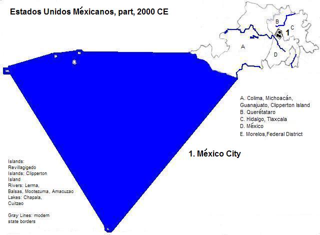
México City, the capital of México and its largest city, is located in the valley of México in the plateau of central México, centered on the site of a lake that is now mostly drained. There are 23.6 million metropolitan residents.
Within the metropolitan area is Ecatepec, also known as Ecatepec de Morelos, with a current population of nearly 2 million.
The third city in the metropolitan area with more than a million residents is Nezhualcóyotl, or Neza for short, located in the drained portion of Lake Texcoco and having about 1.2 million residents.
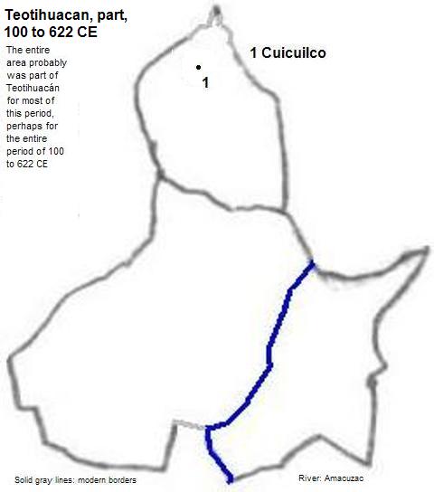
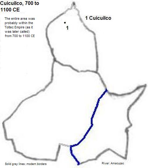
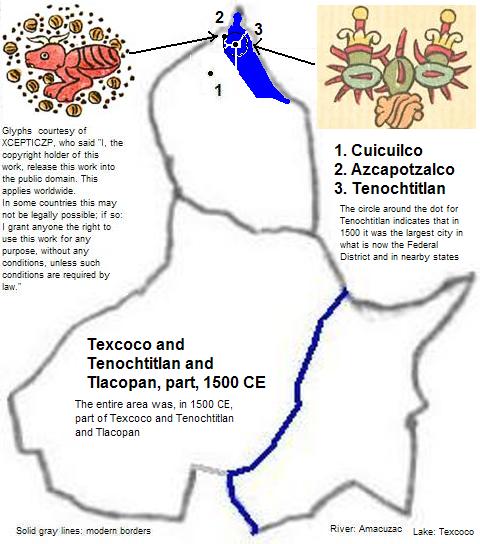
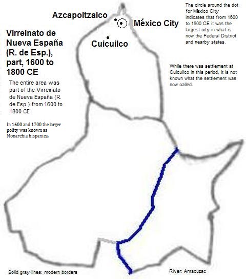
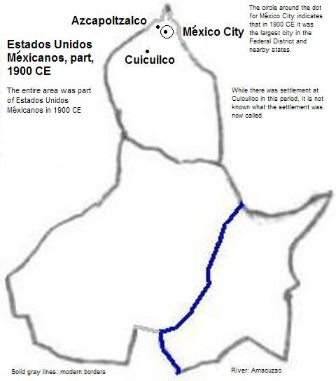
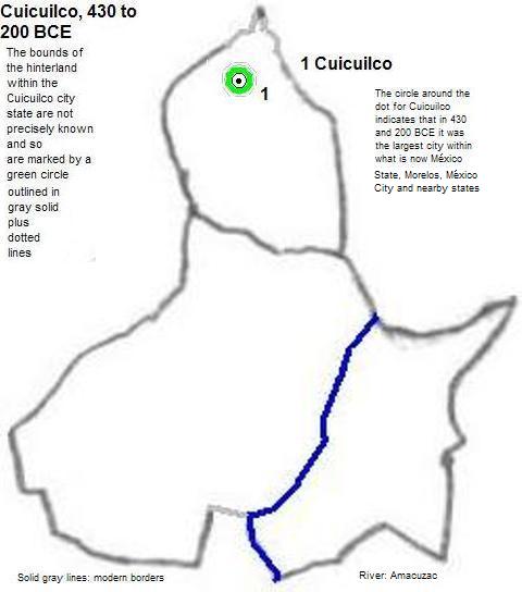
The earliest major settlement, Cuicuilco, was in the south of the present city, below the volano, Xitle, which destroyed the city in the first millenium, with the survivors moving north to Teotihuacán. The site was nonetheless re-settled later in the millenium. In the 20th century the area became part of México City.
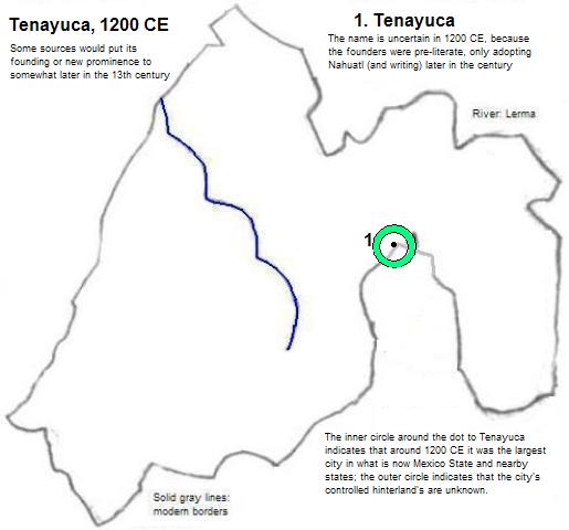
Tenayuca, located in today's Tlalnepantla just outside the city limits
Texcoco is located on what used to be the eastern shore of the lake with its name. Today it is a city of about 130 thousand
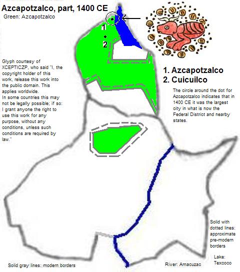
Azcapotzalco, whose name means Anthill in Nahuatl, is located in the northwest of the current city, and became pre-eminent in the late 14th century but was conquered by the Aztec-dominated Triple Alliance in the early 15th century. It remained a separate city until 1928. Later in the 20th century it was formally incorporated into México City.
Tenochtitlan, whose name means Prickly Pear Among the Rocks, was founded in the south end of an island in what was then part of Lake Texcoco and is today Zócalo Square. It was connected to the mainland by causeways with movable bridges. The lake was dammed to make part of it fresh. Tenochtitlan arose to pre-eminence in the early 15th century as the senior partner of the Triple Alliance, which is retrospectively called the Aztec Empire. It fell to the Spanish in the early 16th century, who renamed it México City
There are four World Heritage Sites. The Central University City Campus of the Universidad Nacional Autónoma de México (National Autonomous University of México), built between 1949 and 1952, is most famous for the Biblioteca Central (Central Library) building, which is covered with tile-art by Juan O'Gorman. The Historic Centre of México City and Xochimilco includes the cathedral and the Palacio de las Bellas Artes (Palace of Fine Arts) from the post-Columbian period, and the Templo Mayor (Great Temple) from Aztec times. In the south end of the city is Xochimilco with its famous chinampas (floating gardens). The Luis Barragán House and Studio, from 1948, exhibits that architects work. Beyond the city proper, in Cuernavaca, is one of the 16th century monasteries that are part of a World Heritage Site. This one is now the city's cathedral.
| Name | Year | Population | Political entity |
| Cuicuilco | 430 BCE | Cuicuilco | |
| Cuicuilco | 200 BCE | Cuicuilco | |
| Tenayuca | 1200 CE | 50,000| Tenayuca | |
| Texcoco | 1300 CE | 50,000| Texcoco | |
| Azcapotzalco | 1400 CE | | Azcapotzalco | |
| Tenochtitlan | 1500 CE | 80,000 | Texcoco and Tenochtitlan and Tlacopan (Triple Alliance or Aztec Empire) |
| México City | 1600 CE | 58,000 | Virreinato de Nueva España (Viceroyalty of New Spain, part of the Reino de España or Kingdom of Spain) |
| México City | 1700 CE | 85,000 | Virreinato de Nueva España (Viceroyalty of New Spain, part of the Reino de España or Kingdom of Spain) |
| México City | 1800 CE | 128,000 | Virreinato de Nueva España (Viceroyalty of New Spain, part of the Reino de España or Kingdom of Spain) |
| México City | 1900 CE | 368,000 | Estados Unidos Méxicanos (United States of Mexico) |
| México City | 2000 CE | 8,605,000 | Estados Unidos Méxicanos (United States of Mexico) |