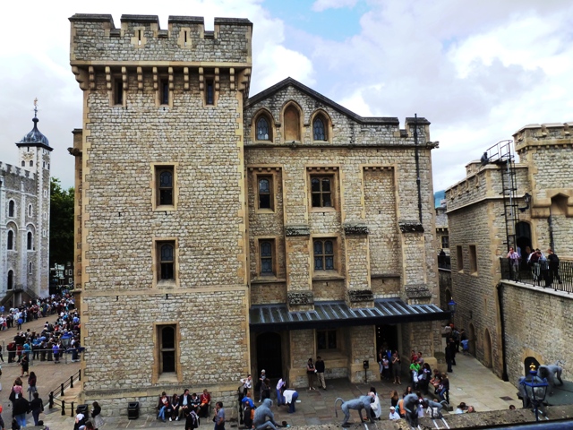
Part of the Tower of London
| To Duval Family Home Page | Europe | |
| To Chris Home Page | United Kingdom | |
| To Earth (Geography Home Page) |
London, the capital of the U.K.
The mathematician, Thomas Harriot, worked in London in the late 16th and early 17th century. Exactly when he did what is not established, but he is known today for contributions to exact interpolation, the logarithmic spiral and the areas of spherical triangles.
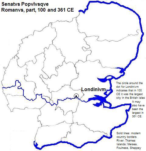
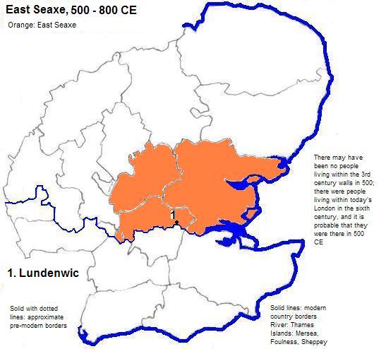
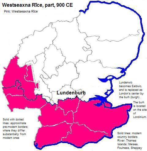
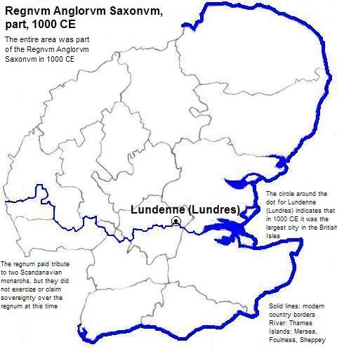
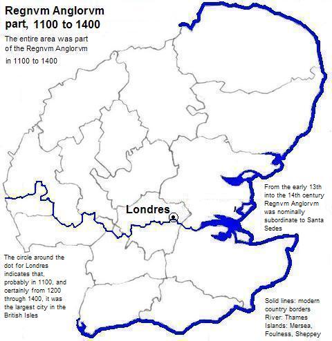
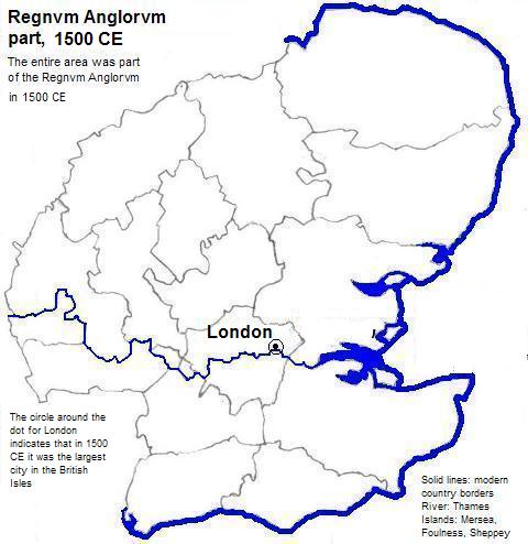
The city was founded by the Romans, who called it Londinivm (Londinium). In Old English it was called Lundenwic, Lundenburh, Lundenburgh, Lundenne and Lundres. In French it is Londres, and perhaps that was its name under the Norman French.
| Year | Population | Political entity |
| 100 CE | 30,000 | Senatvs Popvlvsqve Romanvs |
| 1000 CE | 15,000 | Regnvm Anglorvm Saxonvm (Kingdom of England) |
| 1200 CE | 40,000 | Regnvm Anglorvm (Kingdom of England) |
| 1300 CE | 45,000 | Regnvm Anglorvm (Kingdom of England) |
| 1400 CE | 50,000 | Regnvm Anglorvm (Kingdom of England) |
| 1500 CE | 50,000 | Regnvm Anglorvm (Kingdom of England) |
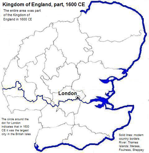
| 1600 CE | 187,000 | Kingdom of England |
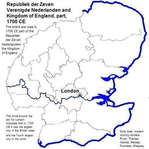
| 1700 CE | 550,000 | Republiek der Zeven Verenigde Nederlanden (United Provinces) and the Kingdom of England |
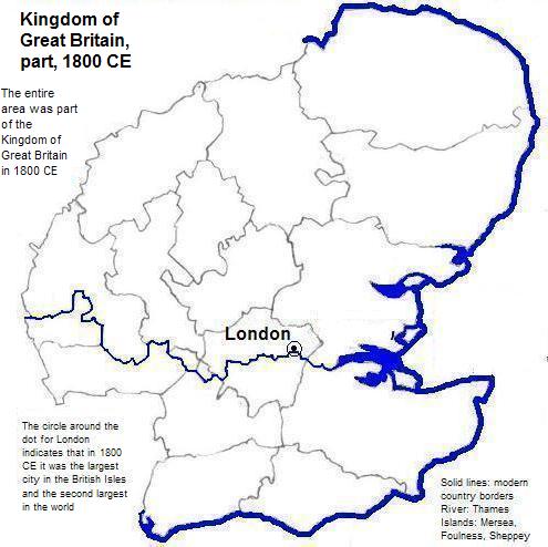
| 1800 CE | 861,000 | Kingdom of Great Britain |
| 1900 CE | 6,480,000 | United Kingdom of Great Britain and Ireland |
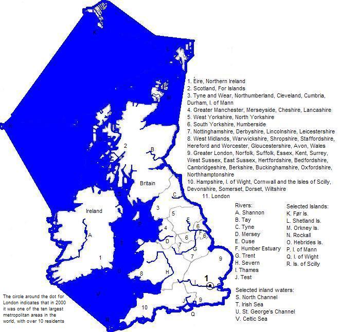
| 2001 CE | 11,962,000 | United Kingdom of Great Britain and Northern Ireland |
Part of the Tower of London
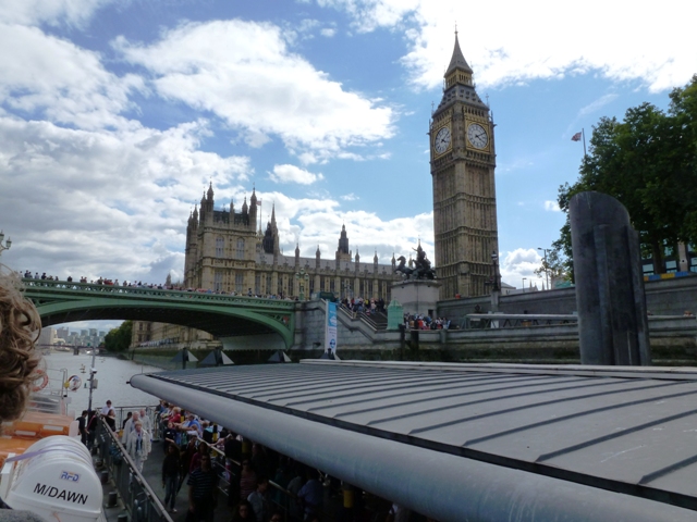
Part of Westminster Palace, with the Clock Tower

1. Full name: the United Kingdom of Great Britain and Northern Ireland.
2. Estimates for all but 2000 in Tables of the World's Largest Cities, in Tertius Chandler, Four Thousand Years of Urban Growth, 2nd ed. (The Edwin Mellen Press, 1987). In 100, 1000, and from 1200 to the present it was the largest city in the British Isles. In 1700 it was the fourth, in 1800 the second, and in 1900 the first ranking city in the world.
3. Formally subordinate to Sancta Sedes (the Holy See).