| To Duval Family Home Page | Europe | |
| To Chris Home Page | Україна (Ukraine) | |
| To Earth (Geography Home Page) |
Київ (Kyyiv)
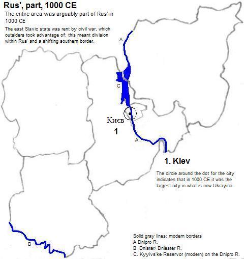
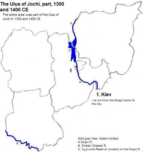
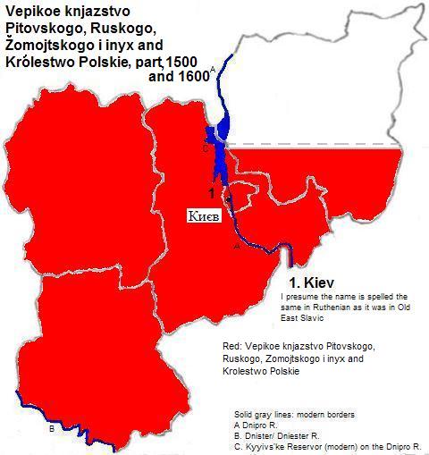
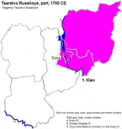
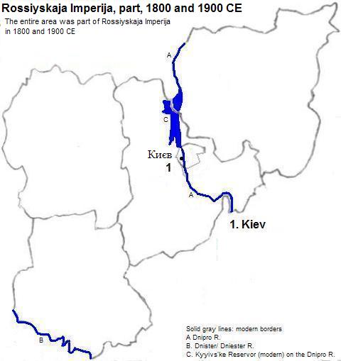
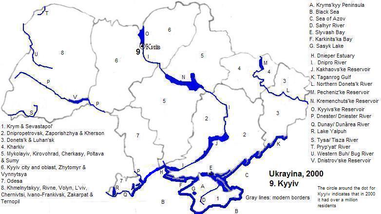
The city rose to prominence in the ninth century, was destroyed by the Mongols in 1240 and was partly rebuilt. It was Lithuanian in the 14th century, was mostly destroyed by the Crimean Tatars in the 15th century, was part of the 16th to 17th century Polish-Lithuanian Commonwealth and became Russian in 1667. In 1991 it became the capital of independent Україна (Ukrayina).
| Year | Population | Political entity |
| 1000 CE | 45,000| Rus' | |
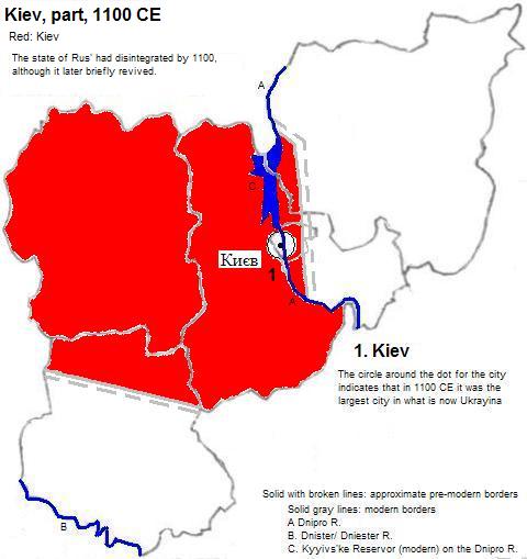
| 1100 CE | 50,000| Києв (Kiev) | |
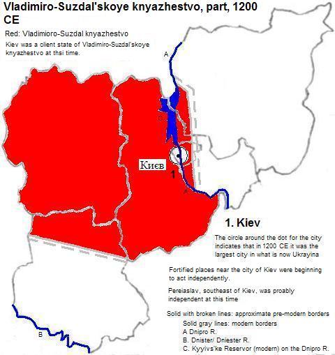
| 1200 CE | 30,000| Vladimiro-Suzdal'skoye knyazhestvo (Vladimir-Suzdal Principality) | |
| 1900 CE | 300,000| Rossiyskaja Imperija (Russian Empire) | |
| 2000 CE | 2,6111,000| Україна (Ukrayina) | |
St. Sophia Cathedral, Kyyiv from above (golden spires, green bases); modern buildings in background
1. Also transliterated as Kyjiv or Kyiv; in Russian: Киев (Kiev); in Polish: Kijow. I do not know what the Lithuanian name for it was. The Ukrainian written form did not exist before the 18th century, although the alternate pronunication is centuries older.
2. World-gazetteer.com, accessed 8/2/2012.
3. Emporis.com, accessed 9/21/2012.
4. Tertius Chandler, Four Thousand Years of Urban Growth, 2nd ed. (The Edwin Mellen Press, 1987), "Tables of World's Largest Cities".
5. The state of Rus' had disintegrated by 1100, although it briefly revived in the early 12th century.
6. Chandler, ibid., Cities of Europe, 1200."
7. Києв (Kiev) was a client state of Vladimiro-Suzdal'skoye knyazhestvo (Vladimir-Suzdal Principality) at this time.
8. Rounded from world-gazeteer.com, 2001 census (city proper), accessed 11/10/2012.