| To Duval Family Home Page | Asia |
| To Chris Home Page | Bengali speaking area |
| To Earth (Geography Home Page) | भारत (Bhārat or India) |
| পশিচণবনগ (Paścimbangga) |
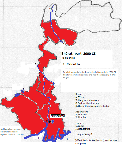
কলকাতা (Kolkata)
The urban area is served by the Netaji Subhas Chandra Bose International Airport, one of the nation's busiest.
হাওড়া (Hāora)
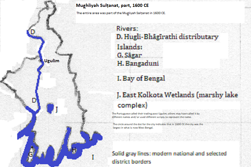
Historically important when the Portuguese called it Ugulim is চুঁচুড়া-হগলি (Chunchura-Hugli),
| Name | Year | Population |
| Ugulim | 1600 CE | 60,000 |
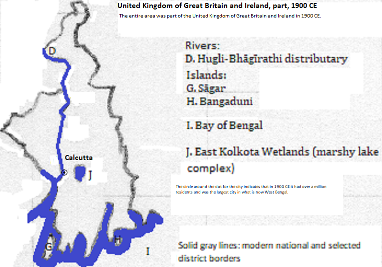
| Calcutta | 1900 CE | 1,085,000 |
| Calcutta | 2012 CE | 16,172,000 |
Hāora Bridge between Kolkata and Hāora, Presidency Division, Paścimbangga, Bhārat
1. Formerly spelled Calcutta in English. The district of Kolkata is part of the city.
2. 2012 calculation for the metropolitan area from world-gazetteer.com, accessed February 6, 2013. https://en.wikipedia.org/wiki/List_of_million-plus_urban_agglomerations_in_India, accessed July 10, 2018, estimated 14.036 million for 2011.
3. 4.497 million in 2011 according to https://en.wikipedia.org/wiki/List_of_cities_in_India_by_population, accessed July 10, 2018.
4. The 42 is listed as topped out but not completed in emporis.com, accessed August 29, 2018.
5. https://en.wikipedia.org/wiki/List_of_the_busiest_airports_in_India, table for April 2017 to March 2018, accessed July 11, 2018.
6. Formerly Howrah in English. It is in its own district in the Presidency Division.
7. 1.072 million in 2011 according to https://en.wikipedia.org/wiki/List_of_cities_in_India_by_population, accessed July 10, 2018.
8. The first part is conventionally transliterated as Chinsurah. Formerly Hooghly in English. Also called either Chinsurah or Hugli. The two cities were merged in the 19th century.
9. 2011 figure from https://en.wikipedia.org/wiki/List_of_cities_in_India_by_population, accessed July 10, 2018. The city is in the Hugli District of the Burdwan Division.
10. Tertius Chandler, Four Thousand Years of Urban Growth, 2nd ed. (The Edwin Mellen Press, 1987), "Tables of the World's Largest Cities." Ugulim was the largest city in what is now West Bengal in 1600. Calcutta was the largest city in that area in 1900 CE.