| To Duval Family Home Page | North America |
| To Chris Home Page | United States of America |
| To Earth (Geography Home Page) | Anglo-North America |
This state lies entirely within the Western Cordillera, divided west-east between the Pacific Mountain System and the Basin and Range Province.
There are oil or gas fields in or by three of the metropolitan areas (Los Angeles County, Fresno County and Solano County) and right next to the city of Bakersfield. Additionally oil and/ or natural gas is found in rural Kern County (South Belridge, Elk Hill and Midway-Sunset fields) and rural Kings County (Kettleman North Dome, which extends into Fresno County).
This state is in the part of North America in which English-speakers and Christians are the majority.
One city's metropolitan area exceeds ten million: Los Angeles-Long Beach-Riverside. Its metropolitan area includes Long Beach, Anaheim, Riverside and Santa Ana.
Cities whose county-based metropolitan areas exceed one million are:
Additionally México's metropolitan area of Méxicali spills over the border to into California.
Other cities of note are South Lake Tahoe and Bakersfield.
Hupa, an Athapascan language, was spoken in northern California.
The Penutian languages--in the narrower sense
The two Yuki languages were also spoken in northern California. Two languages that are sometimes lumped together along with the Algonquian Group--Yorok and Wiyot--were also spoken in the top of the Pacific coast state.
One northern California former religion included the Kuksu cult and god impersonation rites.
The Hokan languages are spoken in California (among other groups) and elsewhere.
Uto-Aztecan languages were spoken in arid California, north of Yuman land. Some Shoshone had migrated to the coast as well.
The Spanish arrived in the 18th century, killing, enslaving and forcibly converting indiginous peoples living near their settlements. The English-speaking United States conquered California in the 19th century, but the Spanish heritage endures, partly due to the large number of immigrants from Mexico.
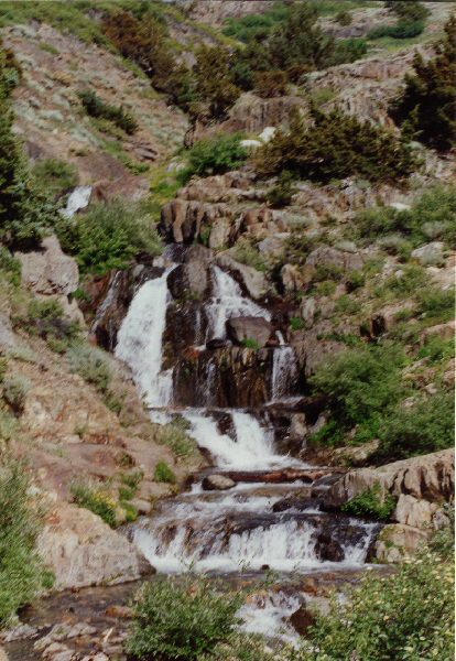
Mountain brook in a high valley with the Sierra Nevada, near Mineral King, in Sequoia National Park, California, United States of America
north
east of the northern and central state
east of southern California
south
west
1. Part of the Intermontane Plateaus.
2. http://www.touropia.com/tourist-attractions-in-california/#, accessed December 26, 2016. This site lists the Tunnel View within Yosemite National Park rather than the park as a whole.
3. Excluding the Mayan, Mixe-Zaquean and Totonacan families, and excluding Zuni and Huave. It includes the Sahoptin-Nez Pierce Group.